Gerrots | |
|---|---|
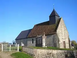 The church in Gerrots | |
Location of Gerrots | |
 Gerrots  Gerrots | |
| Coordinates: 49°11′37″N 0°00′14″W / 49.1936°N 0.0039°W | |
| Country | France |
| Region | Normandy |
| Department | Calvados |
| Arrondissement | Lisieux |
| Canton | Mézidon Vallée d'Auge |
| Government | |
| • Mayor (2020–2026) | Sylvie Pesnel[1] |
| Area 1 | 3.48 km2 (1.34 sq mi) |
| Population | 51 |
| • Density | 15/km2 (38/sq mi) |
| Time zone | UTC+01:00 (CET) |
| • Summer (DST) | UTC+02:00 (CEST) |
| INSEE/Postal code | 14300 /14430 |
| Elevation | 16–123 m (52–404 ft) (avg. 32 m or 105 ft) |
| 1 French Land Register data, which excludes lakes, ponds, glaciers > 1 km2 (0.386 sq mi or 247 acres) and river estuaries. | |
Gerrots (French pronunciation: [ʒɛʁo] ⓘ) is a commune in the Calvados department in the Normandy region in northwestern France.
Population
| Year | Pop. | ±% p.a. |
|---|---|---|
| 1968 | 38 | — |
| 1975 | 40 | +0.74% |
| 1982 | 45 | +1.70% |
| 1990 | 44 | −0.28% |
| 1999 | 37 | −1.91% |
| 2009 | 55 | +4.04% |
| 2014 | 54 | −0.37% |
| 2020 | 51 | −0.95% |
| Source: INSEE[3] | ||
See also
References
- ↑ "Répertoire national des élus: les maires". data.gouv.fr, Plateforme ouverte des données publiques françaises (in French). 2 December 2020.
- ↑ "Populations légales 2021". The National Institute of Statistics and Economic Studies. 28 December 2023.
- ↑ Population en historique depuis 1968, INSEE
Wikimedia Commons has media related to Gerrots.
This article is issued from Wikipedia. The text is licensed under Creative Commons - Attribution - Sharealike. Additional terms may apply for the media files.