Donnay | |
|---|---|
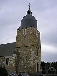 The church in Donnay | |
Location of Donnay | |
 Donnay  Donnay | |
| Coordinates: 48°57′15″N 0°24′57″W / 48.9542°N 0.4158°W | |
| Country | France |
| Region | Normandy |
| Department | Calvados |
| Arrondissement | Caen |
| Canton | Le Hom |
| Intercommunality | Cingal-Suisse Normande |
| Government | |
| • Mayor (2020–2026) | Théophile Lecerf[1] |
| Area 1 | 11.19 km2 (4.32 sq mi) |
| Population | 311 |
| • Density | 28/km2 (72/sq mi) |
| Time zone | UTC+01:00 (CET) |
| • Summer (DST) | UTC+02:00 (CEST) |
| INSEE/Postal code | 14226 /14220 |
| Elevation | 110–297 m (361–974 ft) (avg. 250 m or 820 ft) |
| 1 French Land Register data, which excludes lakes, ponds, glaciers > 1 km2 (0.386 sq mi or 247 acres) and river estuaries. | |
Donnay (French pronunciation: [dɔnɛ] ⓘ) is a commune in the Calvados department and Normandy region of north-western France.
The commune is part of the area known as Suisse Normande.[3]
Population
| Year | Pop. | ±% p.a. |
|---|---|---|
| 1968 | 200 | — |
| 1975 | 169 | −2.38% |
| 1982 | 172 | +0.25% |
| 1990 | 177 | +0.36% |
| 1999 | 190 | +0.79% |
| 2009 | 182 | −0.43% |
| 2014 | 258 | +7.23% |
| 2020 | 302 | +2.66% |
| Source: INSEE[4] | ||
See also
References
- ↑ "Répertoire national des élus: les maires". data.gouv.fr, Plateforme ouverte des données publiques françaises (in French). 2 December 2020.
- ↑ "Populations légales 2021". The National Institute of Statistics and Economic Studies. 28 December 2023.
- ↑ "Map of Suiss Normande" (PDF).
- ↑ Population en historique depuis 1968, INSEE
Wikimedia Commons has media related to Donnay.
This article is issued from Wikipedia. The text is licensed under Creative Commons - Attribution - Sharealike. Additional terms may apply for the media files.