Urville | |
|---|---|
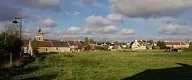 A general view of Urville | |
Location of Urville | |
 Urville  Urville | |
| Coordinates: 49°01′35″N 0°17′46″W / 49.0264°N 0.2961°W | |
| Country | France |
| Region | Normandy |
| Department | Calvados |
| Arrondissement | Caen |
| Canton | Le Hom |
| Intercommunality | Cingal-Suisse Normande |
| Government | |
| • Mayor (2020–2026) | Patrick Morel[1] |
| Area 1 | 6.02 km2 (2.32 sq mi) |
| Population | 743 |
| • Density | 120/km2 (320/sq mi) |
| Time zone | UTC+01:00 (CET) |
| • Summer (DST) | UTC+02:00 (CEST) |
| INSEE/Postal code | 14719 /14190 |
| Elevation | 66–136 m (217–446 ft) (avg. 100 m or 330 ft) |
| 1 French Land Register data, which excludes lakes, ponds, glaciers > 1 km2 (0.386 sq mi or 247 acres) and river estuaries. | |
Urville (French pronunciation: [yʁvil] ⓘ) is a commune in the Calvados department and Normandy region of north-western France.
Iron mining was an important industry in the village until 1989.[3] The village was at the head of a mineral railway linking the iron mines to the SMN steel mills.[3]
Population
| Year | Pop. | ±% |
|---|---|---|
| 1962 | 470 | — |
| 1968 | 484 | +3.0% |
| 1975 | 501 | +3.5% |
| 1982 | 543 | +8.4% |
| 1990 | 519 | −4.4% |
| 1999 | 478 | −7.9% |
| 2007 | 465 | −2.7% |
| 2014 | 623 | +34.0% |
See also
References
- ↑ "Répertoire national des élus: les maires". data.gouv.fr, Plateforme ouverte des données publiques françaises (in French). 9 August 2021.
- ↑ "Populations légales 2021". The National Institute of Statistics and Economic Studies. 28 December 2023.
- 1 2 fleurysien.com
Wikimedia Commons has media related to Urville (Calvados).
This article is issued from Wikipedia. The text is licensed under Creative Commons - Attribution - Sharealike. Additional terms may apply for the media files.