Castelnau-sur-l'Auvignon | |
|---|---|
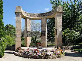 War memorial | |
Location of Castelnau-sur-l'Auvignon | |
 Castelnau-sur-l'Auvignon  Castelnau-sur-l'Auvignon | |
| Coordinates: 43°58′22″N 0°27′28″E / 43.9728°N 0.4578°E | |
| Country | France |
| Region | Occitania |
| Department | Gers |
| Arrondissement | Condom |
| Canton | Baïse-Armagnac |
| Intercommunality | Ténarèze |
| Government | |
| • Mayor (2020–2026) | Maurice Boison[1] |
| Area 1 | 10.22 km2 (3.95 sq mi) |
| Population | 146 |
| • Density | 14/km2 (37/sq mi) |
| Time zone | UTC+01:00 (CET) |
| • Summer (DST) | UTC+02:00 (CEST) |
| INSEE/Postal code | 32080 /32100 |
| Elevation | 98–209 m (322–686 ft) (avg. 166 m or 545 ft) |
| 1 French Land Register data, which excludes lakes, ponds, glaciers > 1 km2 (0.386 sq mi or 247 acres) and river estuaries. | |
Castelnau-sur-l'Auvignon (French pronunciation: [kastɛlno syʁ loviɲɔ̃]; Occitan: Castèthnau d'Auvinhon) is a commune in the Gers department in southwestern France.
Geography
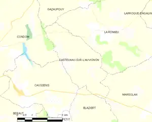
Castelnau-sur-l'Auvignon and its surrounding communes
Population
| Year | Pop. | ±% |
|---|---|---|
| 1962 | 179 | — |
| 1968 | 157 | −12.3% |
| 1975 | 147 | −6.4% |
| 1982 | 148 | +0.7% |
| 1990 | 139 | −6.1% |
| 1999 | 161 | +15.8% |
| 2008 | 159 | −1.2% |
See also
References
- ↑ "Répertoire national des élus: les maires". data.gouv.fr, Plateforme ouverte des données publiques françaises (in French). 2 December 2020.
- ↑ "Populations légales 2021". The National Institute of Statistics and Economic Studies. 28 December 2023.
Wikimedia Commons has media related to Castelnau-sur-l'Auvignon.
This article is issued from Wikipedia. The text is licensed under Creative Commons - Attribution - Sharealike. Additional terms may apply for the media files.