Lagraulet-du-Gers | |
|---|---|
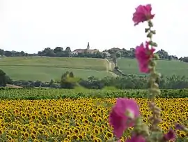 A general view of Lagraulet-du-Gers | |
Location of Lagraulet-du-Gers | |
 Lagraulet-du-Gers  Lagraulet-du-Gers | |
| Coordinates: 43°54′16″N 0°12′48″E / 43.9044°N 0.2133°E | |
| Country | France |
| Region | Occitania |
| Department | Gers |
| Arrondissement | Condom |
| Canton | Armagnac-Ténarèze |
| Government | |
| • Mayor (2020–2026) | Nicolas Meliet[1] |
| Area 1 | 27.22 km2 (10.51 sq mi) |
| Population | 562 |
| • Density | 21/km2 (53/sq mi) |
| Time zone | UTC+01:00 (CET) |
| • Summer (DST) | UTC+02:00 (CEST) |
| INSEE/Postal code | 32180 /32330 |
| Elevation | 85–186 m (279–610 ft) |
| 1 French Land Register data, which excludes lakes, ponds, glaciers > 1 km2 (0.386 sq mi or 247 acres) and river estuaries. | |
Lagraulet-du-Gers (French pronunciation: [laɡʁolɛ dy ʒɛʁ(s)]; Occitan: L'Agraulet de Gers) is a commune in the Gers department in southwestern France.
Geography
The Auzoue flows north through the middle of the commune.
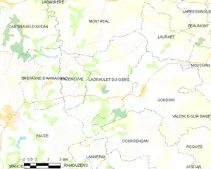
Lagraulet-du-Gers and its surrounding communes
Population
| Year | Pop. | ±% |
|---|---|---|
| 1962 | 575 | — |
| 1968 | 545 | −5.2% |
| 1975 | 410 | −24.8% |
| 1982 | 427 | +4.1% |
| 1990 | 395 | −7.5% |
| 1999 | 381 | −3.5% |
| 2008 | 399 | +4.7% |
See also
References
- ↑ "Répertoire national des élus: les maires". data.gouv.fr, Plateforme ouverte des données publiques françaises (in French). 2 December 2020.
- ↑ "Populations légales 2021". The National Institute of Statistics and Economic Studies. 28 December 2023.
Wikimedia Commons has media related to Lagraulet-du-Gers.
This article is issued from Wikipedia. The text is licensed under Creative Commons - Attribution - Sharealike. Additional terms may apply for the media files.