Saint-Mézard | |
|---|---|
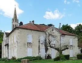 The church in Saint-Mézard | |
Location of Saint-Mézard | |
 Saint-Mézard  Saint-Mézard | |
| Coordinates: 44°01′59″N 0°33′36″E / 44.0331°N 0.56°E | |
| Country | France |
| Region | Occitania |
| Department | Gers |
| Arrondissement | Condom |
| Canton | Lectoure-Lomagne |
| Intercommunality | Lomagne Gersoise |
| Government | |
| • Mayor (2022–2026) | Vincent Zambonini[1] |
| Area 1 | 15.11 km2 (5.83 sq mi) |
| Population | 242 |
| • Density | 16/km2 (41/sq mi) |
| Time zone | UTC+01:00 (CET) |
| • Summer (DST) | UTC+02:00 (CEST) |
| INSEE/Postal code | 32396 /32700 |
| Elevation | 62–222 m (203–728 ft) (avg. 180 m or 590 ft) |
| 1 French Land Register data, which excludes lakes, ponds, glaciers > 1 km2 (0.386 sq mi or 247 acres) and river estuaries. | |
Saint-Mézard (French pronunciation: [sɛ̃ mezaʁ]; Occitan: Sent Mesard) is a commune in the Gers department in southwestern France.
Geography
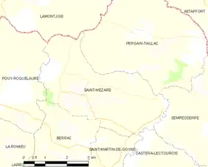
Saint-Mézard and its surrounding communes
Population
| Year | Pop. | ±% |
|---|---|---|
| 1962 | 327 | — |
| 1968 | 314 | −4.0% |
| 1975 | 251 | −20.1% |
| 1982 | 236 | −6.0% |
| 1990 | 238 | +0.8% |
| 1999 | 202 | −15.1% |
| 2008 | 208 | +3.0% |
See also
References
- ↑ "Répertoire national des élus: les maires" (in French). data.gouv.fr, Plateforme ouverte des données publiques françaises. 4 May 2022.
- ↑ "Populations légales 2021". The National Institute of Statistics and Economic Studies. 28 December 2023.
Wikimedia Commons has media related to Saint-Mézard.
This article is issued from Wikipedia. The text is licensed under Creative Commons - Attribution - Sharealike. Additional terms may apply for the media files.