Fougerolles | |
|---|---|
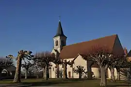 The church of Saint-Pierre, in Fougerolles | |
Location of Fougerolles | |
 Fougerolles  Fougerolles | |
| Coordinates: 46°33′50″N 1°52′02″E / 46.5639°N 1.8672°E | |
| Country | France |
| Region | Centre-Val de Loire |
| Department | Indre |
| Arrondissement | La Châtre |
| Canton | Neuvy-Saint-Sépulchre |
| Government | |
| • Mayor (2020–2026) | Arnaud Denormandie[1] |
| Area 1 | 17.17 km2 (6.63 sq mi) |
| Population | 353 |
| • Density | 21/km2 (53/sq mi) |
| Time zone | UTC+01:00 (CET) |
| • Summer (DST) | UTC+02:00 (CEST) |
| INSEE/Postal code | 36078 /36230 |
| Elevation | 187–284 m (614–932 ft) (avg. 250 m or 820 ft) |
| 1 French Land Register data, which excludes lakes, ponds, glaciers > 1 km2 (0.386 sq mi or 247 acres) and river estuaries. | |
Fougerolles (French pronunciation: [fuʒʁɔl]) is a commune in the Indre department in central France.
Population
| Year | Pop. | ±% p.a. |
|---|---|---|
| 1968 | 377 | — |
| 1975 | 311 | −2.71% |
| 1982 | 289 | −1.04% |
| 1990 | 281 | −0.35% |
| 1999 | 287 | +0.24% |
| 2009 | 326 | +1.28% |
| 2014 | 342 | +0.96% |
| 2020 | 355 | +0.62% |
| Source: INSEE[3] | ||
See also
References
- ↑ "Répertoire national des élus: les maires". data.gouv.fr, Plateforme ouverte des données publiques françaises (in French). 9 August 2021.
- ↑ "Populations légales 2021". The National Institute of Statistics and Economic Studies. 28 December 2023.
- ↑ Population en historique depuis 1968, INSEE
Wikimedia Commons has media related to Fougerolles (Indre).
This article is issued from Wikipedia. The text is licensed under Creative Commons - Attribution - Sharealike. Additional terms may apply for the media files.