Ségry | |
|---|---|
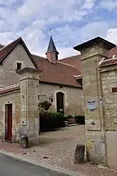 The town hall in Ségry | |
Location of Ségry | |
 Ségry  Ségry | |
| Coordinates: 46°53′29″N 2°05′00″E / 46.8914°N 2.0833°E | |
| Country | France |
| Region | Centre-Val de Loire |
| Department | Indre |
| Arrondissement | Issoudun |
| Canton | Issoudun |
| Intercommunality | CC Pays d'Issoudun |
| Government | |
| • Mayor (2020–2026) | Stéphane Gourier[1] |
| Area 1 | 33.06 km2 (12.76 sq mi) |
| Population | 489 |
| • Density | 15/km2 (38/sq mi) |
| Time zone | UTC+01:00 (CET) |
| • Summer (DST) | UTC+02:00 (CEST) |
| INSEE/Postal code | 36215 /36100 |
| Elevation | 130–176 m (427–577 ft) (avg. 150 m or 490 ft) |
| 1 French Land Register data, which excludes lakes, ponds, glaciers > 1 km2 (0.386 sq mi or 247 acres) and river estuaries. | |
Ségry (French pronunciation: [seɡʁi]) is a commune in the Indre department in central France.[3]
Population
| Year | Pop. | ±% p.a. |
|---|---|---|
| 1968 | 364 | — |
| 1975 | 321 | −1.78% |
| 1982 | 312 | −0.41% |
| 1990 | 442 | +4.45% |
| 1999 | 465 | +0.57% |
| 2009 | 513 | +0.99% |
| 2014 | 537 | +0.92% |
| 2020 | 492 | −1.45% |
| Source: INSEE[4] | ||
See also
References
- ↑ "Répertoire national des élus: les maires". data.gouv.fr, Plateforme ouverte des données publiques françaises (in French). 2 December 2020.
- ↑ "Populations légales 2021". The National Institute of Statistics and Economic Studies. 28 December 2023.
- ↑ INSEE commune file
- ↑ Population en historique depuis 1968, INSEE
Wikimedia Commons has media related to Ségry.
This article is issued from Wikipedia. The text is licensed under Creative Commons - Attribution - Sharealike. Additional terms may apply for the media files.