Frédille | |
|---|---|
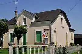 The town hall in Frédille | |
Location of Frédille | |
 Frédille  Frédille | |
| Coordinates: 47°00′11″N 1°28′51″E / 47.0031°N 1.4808°E | |
| Country | France |
| Region | Centre-Val de Loire |
| Department | Indre |
| Arrondissement | Châteauroux |
| Canton | Valençay |
| Government | |
| • Mayor (2020–2026) | Christiane Huot[1] |
| Area 1 | 6.31 km2 (2.44 sq mi) |
| Population | 74 |
| • Density | 12/km2 (30/sq mi) |
| Time zone | UTC+01:00 (CET) |
| • Summer (DST) | UTC+02:00 (CEST) |
| INSEE/Postal code | 36080 /36180 |
| Elevation | 120–172 m (394–564 ft) (avg. 162 m or 531 ft) |
| 1 French Land Register data, which excludes lakes, ponds, glaciers > 1 km2 (0.386 sq mi or 247 acres) and river estuaries. | |
Frédille (French pronunciation: [fʁedij]) is a commune in the Indre department in central France.
Population
| Year | Pop. | ±% p.a. |
|---|---|---|
| 1968 | 121 | — |
| 1975 | 84 | −5.08% |
| 1982 | 81 | −0.52% |
| 1990 | 77 | −0.63% |
| 1999 | 74 | −0.44% |
| 2009 | 63 | −1.60% |
| 2014 | 72 | +2.71% |
| 2020 | 73 | +0.23% |
| Source: INSEE[3] | ||
See also
References
- ↑ "Répertoire national des élus: les maires". data.gouv.fr, Plateforme ouverte des données publiques françaises (in French). 9 August 2021.
- ↑ "Populations légales 2021". The National Institute of Statistics and Economic Studies. 28 December 2023.
- ↑ Population en historique depuis 1968, INSEE
Wikimedia Commons has media related to Frédille.
This article is issued from Wikipedia. The text is licensed under Creative Commons - Attribution - Sharealike. Additional terms may apply for the media files.