Mauléon-d'Armagnac | |
|---|---|
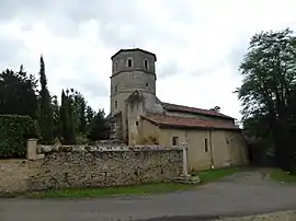 The church of Mauléon-d'Armagnac | |
Location of Mauléon-d'Armagnac | |
 Mauléon-d'Armagnac  Mauléon-d'Armagnac | |
| Coordinates: 43°54′13″N 0°09′08″W / 43.9036°N 0.1522°W | |
| Country | France |
| Region | Occitania |
| Department | Gers |
| Arrondissement | Condom |
| Canton | Grand-Bas-Armagnac |
| Intercommunality | Grand-Armagnac |
| Government | |
| • Mayor (2020–2026) | Daniel Laburthe[1] |
| Area 1 | 35.13 km2 (13.56 sq mi) |
| Population | 263 |
| • Density | 7.5/km2 (19/sq mi) |
| Time zone | UTC+01:00 (CET) |
| • Summer (DST) | UTC+02:00 (CEST) |
| INSEE/Postal code | 32243 /32240 |
| Elevation | 68–153 m (223–502 ft) (avg. 93 m or 305 ft) |
| 1 French Land Register data, which excludes lakes, ponds, glaciers > 1 km2 (0.386 sq mi or 247 acres) and river estuaries. | |
Mauléon-d'Armagnac (French pronunciation: [moleɔ̃ daʁmaɲak], literally Mauléon of Armagnac; Gascon: Mauleon d'Armanhac) is a commune in the Gers department in southwestern France.
Geography
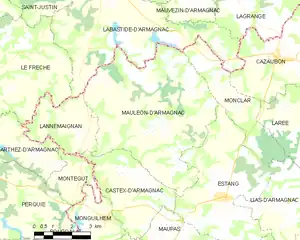
Mauléon-d'Armagnac and its surrounding communes
Population
| Year | Pop. | ±% |
|---|---|---|
| 1962 | 583 | — |
| 1968 | 523 | −10.3% |
| 1975 | 414 | −20.8% |
| 1982 | 369 | −10.9% |
| 1990 | 311 | −15.7% |
| 1999 | 306 | −1.6% |
| 2008 | 281 | −8.2% |
See also
References
- ↑ "Répertoire national des élus: les maires". data.gouv.fr, Plateforme ouverte des données publiques françaises (in French). 9 August 2021.
- ↑ "Populations légales 2021". The National Institute of Statistics and Economic Studies. 28 December 2023.
Wikimedia Commons has media related to Mauléon-d'Armagnac.
This article is issued from Wikipedia. The text is licensed under Creative Commons - Attribution - Sharealike. Additional terms may apply for the media files.