Agassac | |
|---|---|
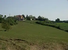 A general view of Agassac | |
Location of Agassac | |
 Agassac  Agassac | |
| Coordinates: 43°22′20″N 0°53′18″E / 43.3722°N 0.8883°E | |
| Country | France |
| Region | Occitania |
| Department | Haute-Garonne |
| Arrondissement | Saint-Gaudens |
| Canton | Cazères |
| Intercommunality | Cœur et Coteaux du Comminges |
| Government | |
| • Mayor (2020–2026) | Serge Ane[1] |
| Area 1 | 9.58 km2 (3.70 sq mi) |
| Population | 119 |
| • Density | 12/km2 (32/sq mi) |
| Time zone | UTC+01:00 (CET) |
| • Summer (DST) | UTC+02:00 (CEST) |
| INSEE/Postal code | 31001 /31230 |
| Elevation | 197–336 m (646–1,102 ft) (avg. 250 m or 820 ft) |
| 1 French Land Register data, which excludes lakes, ponds, glaciers > 1 km2 (0.386 sq mi or 247 acres) and river estuaries. | |
Agassac (French pronunciation: [aɡasak]) is a commune in the Haute-Garonne department in southwestern France.
Geography
The commune is bordered by five other communes: Martisserre to the north, Mauvezin to the east, Castelgaillard to the south Coueilles to the southwest, and finally by L'Isle-en-Dodon to the west.
Population
| Year | Pop. | ±% p.a. |
|---|---|---|
| 1968 | 181 | — |
| 1975 | 142 | −3.41% |
| 1982 | 119 | −2.49% |
| 1990 | 130 | +1.11% |
| 1999 | 121 | −0.79% |
| 2007 | 122 | +0.10% |
| 2012 | 114 | −1.35% |
| 2017 | 118 | +0.69% |
| Source: INSEE[3] | ||
See also
References
- ↑ "Répertoire national des élus: les maires". data.gouv.fr, Plateforme ouverte des données publiques françaises (in French). 9 August 2021.
- ↑ "Populations légales 2021". The National Institute of Statistics and Economic Studies. 28 December 2023.
- ↑ Population en historique depuis 1968, INSEE
Wikimedia Commons has media related to Agassac.
This article is issued from Wikipedia. The text is licensed under Creative Commons - Attribution - Sharealike. Additional terms may apply for the media files.