Plagne | |
|---|---|
Location of Plagne | |
 Plagne  Plagne | |
| Coordinates: 43°09′29″N 1°03′38″E / 43.1581°N 1.0606°E | |
| Country | France |
| Region | Occitania |
| Department | Haute-Garonne |
| Arrondissement | Muret |
| Canton | Cazères |
| Government | |
| • Mayor (2020–2026) | Henri Rouaix[1] |
| Area 1 | 4.15 km2 (1.60 sq mi) |
| Population | 94 |
| • Density | 23/km2 (59/sq mi) |
| Time zone | UTC+01:00 (CET) |
| • Summer (DST) | UTC+02:00 (CEST) |
| INSEE/Postal code | 31422 /31220 |
| Elevation | 316–590 m (1,037–1,936 ft) (avg. 360 m or 1,180 ft) |
| 1 French Land Register data, which excludes lakes, ponds, glaciers > 1 km2 (0.386 sq mi or 247 acres) and river estuaries. | |
Plagne (French pronunciation: [plaɲ]; Occitan: Planha) is a commune in the Haute-Garonne department in southwestern France.
Population
| Year | Pop. | ±% |
|---|---|---|
| 1962 | 44 | — |
| 1968 | 55 | +25.0% |
| 1975 | 70 | +27.3% |
| 1982 | 58 | −17.1% |
| 1990 | 60 | +3.4% |
| 1999 | 88 | +46.7% |
| 2008 | 93 | +5.7% |
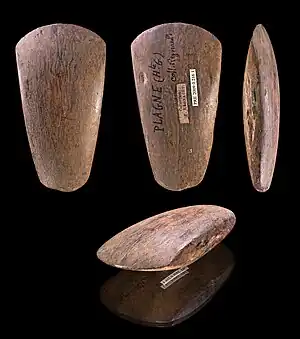
Polished Neolithic ax – Plagne, Museum of Toulouse
See also
References
- ↑ "Répertoire national des élus: les maires". data.gouv.fr, Plateforme ouverte des données publiques françaises (in French). 2 December 2020.
- ↑ "Populations légales 2021". The National Institute of Statistics and Economic Studies. 28 December 2023.
Wikimedia Commons has media related to Plagne (Haute-Garonne).
This article is issued from Wikipedia. The text is licensed under Creative Commons - Attribution - Sharealike. Additional terms may apply for the media files.