Aignes | |
|---|---|
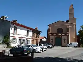 The church in Aignes | |
Location of Aignes | |
 Aignes  Aignes | |
| Coordinates: 43°19′16″N 1°35′22″E / 43.3211°N 1.5894°E | |
| Country | France |
| Region | Occitania |
| Department | Haute-Garonne |
| Arrondissement | Toulouse |
| Canton | Escalquens |
| Intercommunality | Terres du Lauragais |
| Government | |
| • Mayor (2022–2026) | Patrice Ramond[1] |
| Area 1 | 21.81 km2 (8.42 sq mi) |
| Population | 239 |
| • Density | 11/km2 (28/sq mi) |
| Time zone | UTC+01:00 (CET) |
| • Summer (DST) | UTC+02:00 (CEST) |
| INSEE/Postal code | 31002 /31550 |
| Elevation | 198–323 m (650–1,060 ft) (avg. 300 m or 980 ft) |
| 1 French Land Register data, which excludes lakes, ponds, glaciers > 1 km2 (0.386 sq mi or 247 acres) and river estuaries. | |
Aignes (French pronunciation: [ɛɲ]; Occitan: Anhas) is a commune in the Haute-Garonne department in southwestern France.
Geography
The commune is bordered by six other communes: Saint-Léon to the north, Nailloux to the northeast, Montgeard to the east, Calmont to the south, Cintegabelle to the west, and finally by Mauvaisin to the southwest.
Population
| Year | Pop. | ±% p.a. |
|---|---|---|
| 1968 | 219 | — |
| 1975 | 184 | −2.46% |
| 1982 | 176 | −0.63% |
| 1990 | 168 | −0.58% |
| 1999 | 193 | +1.55% |
| 2007 | 231 | +2.27% |
| 2012 | 243 | +1.02% |
| 2017 | 245 | +0.16% |
| Source: INSEE[3] | ||
See also
References
- ↑ "Répertoire national des élus: les maires" (in French). data.gouv.fr, Plateforme ouverte des données publiques françaises. 6 June 2023.
- ↑ "Populations légales 2021". The National Institute of Statistics and Economic Studies. 28 December 2023.
- ↑ Population en historique depuis 1968, INSEE
Wikimedia Commons has media related to Aignes.
This article is issued from Wikipedia. The text is licensed under Creative Commons - Attribution - Sharealike. Additional terms may apply for the media files.