Cierp-Gaud | |
|---|---|
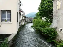 The Pique river in Cierp-Gaud | |
.svg.png.webp) Coat of arms | |
Location of Cierp-Gaud | |
 Cierp-Gaud  Cierp-Gaud | |
| Coordinates: 42°54′59″N 0°38′22″E / 42.9164°N 0.6394°E | |
| Country | France |
| Region | Occitania |
| Department | Haute-Garonne |
| Arrondissement | Saint-Gaudens |
| Canton | Bagnères-de-Luchon |
| Intercommunality | Pyrénées Haut Garonnaises |
| Government | |
| • Mayor (2022–2026) | Claude Guiard[1] |
| Area 1 | 13.90 km2 (5.37 sq mi) |
| Population | 707 |
| • Density | 51/km2 (130/sq mi) |
| Time zone | UTC+01:00 (CET) |
| • Summer (DST) | UTC+02:00 (CEST) |
| INSEE/Postal code | 31144 /31440 |
| Elevation | 460–1,840 m (1,510–6,040 ft) |
| 1 French Land Register data, which excludes lakes, ponds, glaciers > 1 km2 (0.386 sq mi or 247 acres) and river estuaries. | |
Cierp-Gaud is a commune in the Haute-Garonne department in southwestern France.
Population
| Year | Pop. | ±% |
|---|---|---|
| 1962 | 922 | — |
| 1968 | 954 | +3.5% |
| 1975 | 950 | −0.4% |
| 1982 | 944 | −0.6% |
| 1990 | 990 | +4.9% |
| 1999 | 862 | −12.9% |
| 2008 | 917 | +6.4% |
| 2018 | 728 | −20.6% |
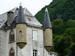 castle
.jpg.webp) church
church
 rocks above the village
 Cierp by Eugène de Malbos near 1840
See also
References
- ↑ "Répertoire national des élus: les maires" (in French). data.gouv.fr, Plateforme ouverte des données publiques françaises. 6 June 2023.
- ↑ "Populations légales 2021". The National Institute of Statistics and Economic Studies. 28 December 2023.
Wikimedia Commons has media related to Cierp-Gaud.
This article is issued from Wikipedia. The text is licensed under Creative Commons - Attribution - Sharealike. Additional terms may apply for the media files.