Lagarde Lauragais | |
|---|---|
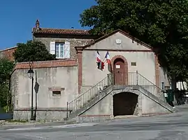 The town hall in Lagarde | |
.svg.png.webp) Coat of arms | |
Location of Lagarde Lauragais | |
 Lagarde Lauragais  Lagarde Lauragais | |
| Coordinates: 43°20′47″N 1°42′50″E / 43.3464°N 1.7139°E | |
| Country | France |
| Region | Occitania |
| Department | Haute-Garonne |
| Arrondissement | Toulouse |
| Canton | Revel |
| Government | |
| • Mayor (2020–2026) | Marielle Peiro-Fournier[1] |
| Area 1 | 11.69 km2 (4.51 sq mi) |
| Population | 435 |
| • Density | 37/km2 (96/sq mi) |
| Time zone | UTC+01:00 (CET) |
| • Summer (DST) | UTC+02:00 (CEST) |
| INSEE/Postal code | 31262 /31290 |
| Elevation | 185–292 m (607–958 ft) (avg. 280 m or 920 ft) |
| 1 French Land Register data, which excludes lakes, ponds, glaciers > 1 km2 (0.386 sq mi or 247 acres) and river estuaries. | |
Lagarde (French pronunciation: [laɡaʁd]; Occitan: La Garda de Lauragués) is a commune in the Haute-Garonne department in southwestern France.
Population
| Year | Pop. | ±% |
|---|---|---|
| 1962 | 230 | — |
| 1968 | 243 | +5.7% |
| 1975 | 195 | −19.8% |
| 1982 | 176 | −9.7% |
| 1990 | 194 | +10.2% |
| 1999 | 239 | +23.2% |
| 2008 | 296 | +23.8% |
See also
References
- ↑ "Répertoire national des élus: les maires". data.gouv.fr, Plateforme ouverte des données publiques françaises (in French). 9 August 2021.
- ↑ "Populations légales 2021". The National Institute of Statistics and Economic Studies. 28 December 2023.
Wikimedia Commons has media related to Lagarde (Haute-Garonne).
This article is issued from Wikipedia. The text is licensed under Creative Commons - Attribution - Sharealike. Additional terms may apply for the media files.