Bouloire | |
|---|---|
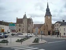 The church of Saint-Georges and the place of the Château | |
Location of Bouloire | |
 Bouloire  Bouloire | |
| Coordinates: 47°58′28″N 0°33′00″E / 47.9744°N 0.55°E | |
| Country | France |
| Region | Pays de la Loire |
| Department | Sarthe |
| Arrondissement | Mamers |
| Canton | Saint-Calais |
| Intercommunality | Le Gesnois Bilurien |
| Government | |
| • Mayor (2020–2026) | Anne-Marie Deloubes[1] |
| Area 1 | 26.77 km2 (10.34 sq mi) |
| Population | 2,115 |
| • Density | 79/km2 (200/sq mi) |
| Demonym(s) | Bilurien, Bilurienne |
| Time zone | UTC+01:00 (CET) |
| • Summer (DST) | UTC+02:00 (CEST) |
| INSEE/Postal code | 72042 /72440 |
| Elevation | 98–176 m (322–577 ft) |
| 1 French Land Register data, which excludes lakes, ponds, glaciers > 1 km2 (0.386 sq mi or 247 acres) and river estuaries. | |
Bouloire (French pronunciation: [bulwaʁ]) is a commune in the Sarthe department in the region of Pays de la Loire in north-western France.
Population
| Year | Pop. | ±% p.a. |
|---|---|---|
| 1968 | 1,532 | — |
| 1975 | 1,433 | −0.95% |
| 1982 | 1,594 | +1.53% |
| 1990 | 1,829 | +1.73% |
| 1999 | 1,883 | +0.32% |
| 2007 | 1,989 | +0.69% |
| 2012 | 2,081 | +0.91% |
| 2017 | 2,082 | +0.01% |
| Source: INSEE[3] | ||
See also
References
- ↑ "Répertoire national des élus: les maires". data.gouv.fr, Plateforme ouverte des données publiques françaises (in French). 2 December 2020.
- ↑ "Populations légales 2021". The National Institute of Statistics and Economic Studies. 28 December 2023.
- ↑ Population en historique depuis 1968, INSEE
Wikimedia Commons has media related to Bouloire.
This article is issued from Wikipedia. The text is licensed under Creative Commons - Attribution - Sharealike. Additional terms may apply for the media files.