Saint-Christophe-du-Jambet | |
|---|---|
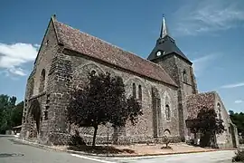 The church of Saint Christophe, in Saint-Christophe-du-Jambet | |
Location of Saint-Christophe-du-Jambet | |
 Saint-Christophe-du-Jambet  Saint-Christophe-du-Jambet | |
| Coordinates: 48°13′53″N 0°02′13″E / 48.2314°N 0.0369°E | |
| Country | France |
| Region | Pays de la Loire |
| Department | Sarthe |
| Arrondissement | Mamers |
| Canton | Sillé-le-Guillaume |
| Intercommunality | Haute Sarthe Alpes Mancelles |
| Government | |
| • Mayor (2020–2026) | Anthony Frileux[1] |
| Area 1 | 11.24 km2 (4.34 sq mi) |
| Population | 231 |
| • Density | 21/km2 (53/sq mi) |
| Time zone | UTC+01:00 (CET) |
| • Summer (DST) | UTC+02:00 (CEST) |
| INSEE/Postal code | 72273 /72170 |
| Elevation | 62–192 m (203–630 ft) |
| 1 French Land Register data, which excludes lakes, ponds, glaciers > 1 km2 (0.386 sq mi or 247 acres) and river estuaries. | |
Saint-Christophe-du-Jambet is a commune in the Sarthe department in the region of Pays de la Loire in north-western France.
See also
References
- ↑ "Répertoire national des élus: les maires". data.gouv.fr, Plateforme ouverte des données publiques françaises (in French). 2 December 2020.
- ↑ "Populations légales 2021". The National Institute of Statistics and Economic Studies. 28 December 2023.
Wikimedia Commons has media related to Saint-Christophe-du-Jambet.
This article is issued from Wikipedia. The text is licensed under Creative Commons - Attribution - Sharealike. Additional terms may apply for the media files.