Tuffé-Val-de-la-Chéronne | |
|---|---|
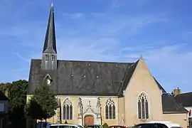 The church of Saint-Pierre and Saint-Paul, in Tuffé | |
Location of Tuffé-Val-de-la-Chéronne | |
 Tuffé-Val-de-la-Chéronne  Tuffé-Val-de-la-Chéronne | |
| Coordinates: 48°06′50″N 0°31′01″E / 48.114°N 0.517°E | |
| Country | France |
| Region | Pays de la Loire |
| Department | Sarthe |
| Arrondissement | Mamers |
| Canton | La Ferté-Bernard |
| Area 1 | 29.16 km2 (11.26 sq mi) |
| Population | 1,667 |
| • Density | 57/km2 (150/sq mi) |
| Time zone | UTC+01:00 (CET) |
| • Summer (DST) | UTC+02:00 (CEST) |
| INSEE/Postal code | 72363 /72160 |
| 1 French Land Register data, which excludes lakes, ponds, glaciers > 1 km2 (0.386 sq mi or 247 acres) and river estuaries. | |
Tuffé-Val-de-la-Chéronne is a commune in the department of Sarthe, western France. The municipality was established on 1 January 2016 by merger of the former communes of Tuffé and Saint-Hilaire-le-Lierru.[2]
See also
References
Wikimedia Commons has media related to Tuffé Val de la Chéronne.
- ↑ "Populations légales 2021". The National Institute of Statistics and Economic Studies. 28 December 2023.
- ↑ Arrêté préfectoral 29 September 2015 (in French)
This article is issued from Wikipedia. The text is licensed under Creative Commons - Attribution - Sharealike. Additional terms may apply for the media files.