Changé | |
|---|---|
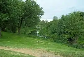 The Auneau creek through the town center | |
Location of Changé | |
 Changé  Changé | |
| Coordinates: 47°59′19″N 0°16′59″E / 47.9886°N 0.2831°E | |
| Country | France |
| Region | Pays de la Loire |
| Department | Sarthe |
| Arrondissement | Le Mans |
| Canton | Changé |
| Intercommunality | Sud-Est du Pays Manceau |
| Government | |
| • Mayor (2020–2026) | Yves-Marie Hervé[1] |
| Area 1 | 35.06 km2 (13.54 sq mi) |
| Population | 6,686 |
| • Density | 190/km2 (490/sq mi) |
| Demonym(s) | Changéen, Changéenne |
| Time zone | UTC+01:00 (CET) |
| • Summer (DST) | UTC+02:00 (CEST) |
| INSEE/Postal code | 72058 /72560 |
| Elevation | 49–127 m (161–417 ft) |
| 1 French Land Register data, which excludes lakes, ponds, glaciers > 1 km2 (0.386 sq mi or 247 acres) and river estuaries. | |
Changé (French pronunciation: [ʃɑ̃ʒe] ⓘ) is a commune in the Sarthe department in the region of Pays de la Loire in north-western France.
Population
| Year | Pop. | ±% p.a. |
|---|---|---|
| 1968 | 2,989 | — |
| 1975 | 3,684 | +3.03% |
| 1982 | 4,072 | +1.44% |
| 1990 | 4,428 | +1.05% |
| 1999 | 5,200 | +1.80% |
| 2007 | 5,735 | +1.23% |
| 2012 | 6,340 | +2.03% |
| 2017 | 6,519 | +0.56% |
| 2020 | 6,569 | +0.26% |
| Source: INSEE[3] | ||
See also
References
- ↑ "Répertoire national des élus: les maires" (in French). data.gouv.fr, Plateforme ouverte des données publiques françaises. 13 September 2022.
- ↑ "Populations légales 2021". The National Institute of Statistics and Economic Studies. 28 December 2023.
- ↑ Population en historique depuis 1968, INSEE
Wikimedia Commons has media related to Changé (Sarthe).
This article is issued from Wikipedia. The text is licensed under Creative Commons - Attribution - Sharealike. Additional terms may apply for the media files.