La Chapelle-Saint-Fray | |
|---|---|
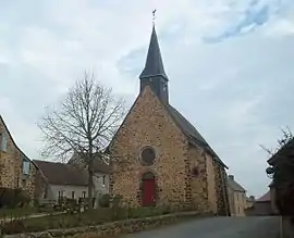 The church | |
Location of La Chapelle-Saint-Fray | |
 La Chapelle-Saint-Fray  La Chapelle-Saint-Fray | |
| Coordinates: 48°06′39″N 0°04′51″E / 48.1108°N 0.0808°E | |
| Country | France |
| Region | Pays de la Loire |
| Department | Sarthe |
| Arrondissement | Mamers |
| Canton | Loué |
| Intercommunality | Champagne Conlinoise et Pays de Sillé |
| Government | |
| • Mayor (2020–2026) | Sonia Moinet[1] |
| Area 1 | 6.38 km2 (2.46 sq mi) |
| Population | 421 |
| • Density | 66/km2 (170/sq mi) |
| Demonym(s) | Capellofrayen, Capellofrayenne |
| Time zone | UTC+01:00 (CET) |
| • Summer (DST) | UTC+02:00 (CEST) |
| INSEE/Postal code | 72066 /72240 |
| 1 French Land Register data, which excludes lakes, ponds, glaciers > 1 km2 (0.386 sq mi or 247 acres) and river estuaries. | |
La Chapelle-Saint-Fray (French pronunciation: [la ʃapɛl sɛ̃ fʁɛ]) is a commune in the Sarthe department in the Pays de la Loire region in north-western France.
See also
References
- ↑ "Répertoire national des élus: les maires". data.gouv.fr, Plateforme ouverte des données publiques françaises (in French). 2 December 2020.
- ↑ "Populations légales 2021". The National Institute of Statistics and Economic Studies. 28 December 2023.
Wikimedia Commons has media related to La Chapelle-Saint-Fray.
This article is issued from Wikipedia. The text is licensed under Creative Commons - Attribution - Sharealike. Additional terms may apply for the media files.