Saint-Ulphace | |
|---|---|
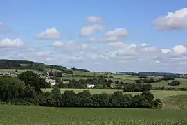 A general view of Saint-Ulphace | |
Location of Saint-Ulphace | |
 Saint-Ulphace  Saint-Ulphace | |
| Coordinates: 48°09′29″N 0°49′03″E / 48.1581°N 0.8175°E | |
| Country | France |
| Region | Pays de la Loire |
| Department | Sarthe |
| Arrondissement | Mamers |
| Canton | Saint-Calais |
| Intercommunality | Pays de l'Huisne Sarthoise |
| Government | |
| • Mayor (2020–2026) | Thierry Guerin[1] |
| Area 1 | 15.98 km2 (6.17 sq mi) |
| Population | 222 |
| • Density | 14/km2 (36/sq mi) |
| Time zone | UTC+01:00 (CET) |
| • Summer (DST) | UTC+02:00 (CEST) |
| INSEE/Postal code | 72322 /72320 |
| Elevation | 143–251 m (469–823 ft) |
| 1 French Land Register data, which excludes lakes, ponds, glaciers > 1 km2 (0.386 sq mi or 247 acres) and river estuaries. | |
Saint-Ulphace (French pronunciation: [sɛ̃.t‿ylfas]) is a commune in the Sarthe department in the region of Pays de la Loire in north-western France.
See also
References
- ↑ "Répertoire national des élus: les maires". data.gouv.fr, Plateforme ouverte des données publiques françaises (in French). 2 December 2020.
- ↑ "Populations légales 2021". The National Institute of Statistics and Economic Studies. 28 December 2023.
Wikimedia Commons has media related to Saint-Ulphace.
This article is issued from Wikipedia. The text is licensed under Creative Commons - Attribution - Sharealike. Additional terms may apply for the media files.