Frugières-le-Pin | |
|---|---|
Commune | |
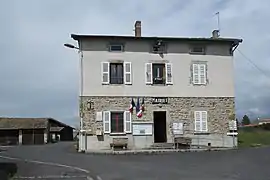 Town hall | |
Location of Frugières-le-Pin | |
 Frugières-le-Pin  Frugières-le-Pin | |
| Coordinates: 45°16′09″N 3°29′19″E / 45.2692°N 3.4886°E | |
| Country | France |
| Region | Auvergne-Rhône-Alpes |
| Department | Haute-Loire |
| Arrondissement | Brioude |
| Canton | Pays de Lafayette |
| Government | |
| • Mayor (2020–2026) | Maurice Laurent[1] |
| Area 1 | 11.57 km2 (4.47 sq mi) |
| Population | 181 |
| • Density | 16/km2 (41/sq mi) |
| Time zone | UTC+01:00 (CET) |
| • Summer (DST) | UTC+02:00 (CEST) |
| INSEE/Postal code | 43100 /43230 |
| Elevation | 467–766 m (1,532–2,513 ft) (avg. 488 m or 1,601 ft) |
| 1 French Land Register data, which excludes lakes, ponds, glaciers > 1 km2 (0.386 sq mi or 247 acres) and river estuaries. | |
Frugières-le-Pin (French pronunciation: [fʁyʒjɛʁ lə pɛ̃]) is a commune in the Haute-Loire department in south-central France.
Geography
The Senouire forms most of the commune's southern boundary.
Population
| Year | Pop. | ±% p.a. |
|---|---|---|
| 1968 | 213 | — |
| 1975 | 149 | −4.98% |
| 1982 | 120 | −3.04% |
| 1990 | 131 | +1.10% |
| 1999 | 121 | −0.88% |
| 2009 | 138 | +1.32% |
| 2014 | 149 | +1.55% |
| 2020 | 181 | +3.30% |
| Source: INSEE[3] | ||
See also
References
- ↑ "Répertoire national des élus: les maires". data.gouv.fr, Plateforme ouverte des données publiques françaises (in French). 2 December 2020.
- ↑ "Populations légales 2021". The National Institute of Statistics and Economic Studies. 28 December 2023.
- ↑ Population en historique depuis 1968, INSEE
Wikimedia Commons has media related to Frugières-le-Pin.
This article is issued from Wikipedia. The text is licensed under Creative Commons - Attribution - Sharealike. Additional terms may apply for the media files.