Vergongheon | |
|---|---|
Commune | |
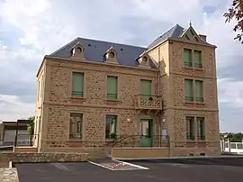 Town hall | |
Location of Vergongheon | |
 Vergongheon  Vergongheon | |
| Coordinates: 45°22′19″N 3°19′13″E / 45.3719°N 3.3203°E | |
| Country | France |
| Region | Auvergne-Rhône-Alpes |
| Department | Haute-Loire |
| Arrondissement | Brioude |
| Canton | Sainte-Florine |
| Government | |
| • Mayor (2020–2026) | Jean-Paul Pastourel[1] |
| Area 1 | 12.61 km2 (4.87 sq mi) |
| Population | 1,799 |
| • Density | 140/km2 (370/sq mi) |
| Time zone | UTC+01:00 (CET) |
| • Summer (DST) | UTC+02:00 (CEST) |
| INSEE/Postal code | 43258 /43360 |
| Elevation | 403–483 m (1,322–1,585 ft) |
| 1 French Land Register data, which excludes lakes, ponds, glaciers > 1 km2 (0.386 sq mi or 247 acres) and river estuaries. | |
Vergongheon (French pronunciation: [vɛʁɡɔ̃ʒɔ̃]; Occitan: Vergonjon) is a commune in the Haute-Loire department in south-central France.
Population
| Year | Pop. | ±% p.a. |
|---|---|---|
| 1968 | 1,686 | — |
| 1975 | 1,664 | −0.19% |
| 1982 | 1,859 | +1.60% |
| 1990 | 1,725 | −0.93% |
| 1999 | 1,608 | −0.78% |
| 2009 | 1,835 | +1.33% |
| 2014 | 1,834 | −0.01% |
| 2020 | 1,810 | −0.22% |
| Source: INSEE[3] | ||
See also
References
- ↑ "Répertoire national des élus: les maires". data.gouv.fr, Plateforme ouverte des données publiques françaises (in French). 2 December 2020.
- ↑ "Populations légales 2021". The National Institute of Statistics and Economic Studies. 28 December 2023.
- ↑ Population en historique depuis 1968, INSEE
Wikimedia Commons has media related to Vergongheon.
This article is issued from Wikipedia. The text is licensed under Creative Commons - Attribution - Sharealike. Additional terms may apply for the media files.