Pruillé-l'Éguillé | |
|---|---|
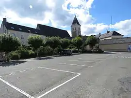 The church of Saint-Christophe, in Pruillé-l'Éguillé | |
Location of Pruillé-l'Éguillé | |
 Pruillé-l'Éguillé  Pruillé-l'Éguillé | |
| Coordinates: 47°50′14″N 0°25′54″E / 47.8372°N 0.4317°E | |
| Country | France |
| Region | Pays de la Loire |
| Department | Sarthe |
| Arrondissement | La Flèche |
| Canton | Montval-sur-Loir |
| Intercommunality | Loir-Lucé-Bercé |
| Government | |
| • Mayor (2020–2026) | Myriam Martineau[1] |
| Area 1 | 21.18 km2 (8.18 sq mi) |
| Population | 814 |
| • Density | 38/km2 (100/sq mi) |
| Demonym | Pruilléen ou Lostre |
| Time zone | UTC+01:00 (CET) |
| • Summer (DST) | UTC+02:00 (CEST) |
| INSEE/Postal code | 72248 /72150 |
| Elevation | 88–167 m (289–548 ft) |
| 1 French Land Register data, which excludes lakes, ponds, glaciers > 1 km2 (0.386 sq mi or 247 acres) and river estuaries. | |
Pruillé-l'Éguillé is a commune in the Sarthe department in the region of Pays de la Loire in north-western France.
See also
References
- ↑ "Répertoire national des élus: les maires" (in French). data.gouv.fr, Plateforme ouverte des données publiques françaises. 13 September 2022.
- ↑ "Populations légales 2021". The National Institute of Statistics and Economic Studies. 28 December 2023.
Wikimedia Commons has media related to Pruillé-l'Éguillé.
This article is issued from Wikipedia. The text is licensed under Creative Commons - Attribution - Sharealike. Additional terms may apply for the media files.