Ambonil | |
|---|---|
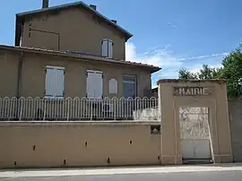 The town hall in Ambonil | |
Location of Ambonil | |
 Ambonil  Ambonil | |
| Coordinates: 44°47′43″N 4°54′33″E / 44.7953°N 4.9092°E | |
| Country | France |
| Region | Auvergne-Rhône-Alpes |
| Department | Drôme |
| Arrondissement | Die |
| Canton | Loriol-sur-Drôme |
| Intercommunality | Val de Drôme en Biovallée |
| Government | |
| • Mayor (2020–2026) | Bernard Carrères[1] |
| Area 1 | 1.23 km2 (0.47 sq mi) |
| Population | 99 |
| • Density | 80/km2 (210/sq mi) |
| Time zone | UTC+01:00 (CET) |
| • Summer (DST) | UTC+02:00 (CEST) |
| INSEE/Postal code | 26007 /26800 |
| Elevation | 134–159 m (440–522 ft) |
| 1 French Land Register data, which excludes lakes, ponds, glaciers > 1 km2 (0.386 sq mi or 247 acres) and river estuaries. | |
Ambonil (French pronunciation: [ɑ̃bɔnil]) is a commune in the Drôme department in southeastern France.
Population
| Year | Pop. | ±% p.a. |
|---|---|---|
| 1968 | 75 | — |
| 1975 | 59 | −3.37% |
| 1982 | 59 | +0.00% |
| 1990 | 69 | +1.98% |
| 1999 | 100 | +4.21% |
| 2009 | 120 | +1.84% |
| 2014 | 127 | +1.14% |
| 2020 | 101 | −3.75% |
| Source: INSEE[3] | ||
See also
References
- ↑ "Répertoire national des élus: les maires". data.gouv.fr, Plateforme ouverte des données publiques françaises (in French). 2 December 2020.
- ↑ "Populations légales 2021". The National Institute of Statistics and Economic Studies. 28 December 2023.
- ↑ Population en historique depuis 1968, INSEE
Wikimedia Commons has media related to Ambonil.
This article is issued from Wikipedia. The text is licensed under Creative Commons - Attribution - Sharealike. Additional terms may apply for the media files.