Souspierre | |
|---|---|
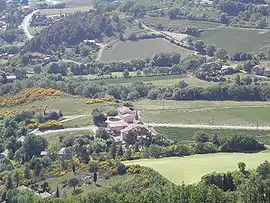 A general view of Souspierre | |
Location of Souspierre | |
 Souspierre  Souspierre | |
| Coordinates: 44°32′31″N 4°57′36″E / 44.542°N 4.960°E | |
| Country | France |
| Region | Auvergne-Rhône-Alpes |
| Department | Drôme |
| Arrondissement | Nyons |
| Canton | Dieulefit |
| Government | |
| • Mayor (2020–2026) | Pierre Mossaz[1] |
| Area 1 | 5.25 km2 (2.03 sq mi) |
| Population | 107 |
| • Density | 20/km2 (53/sq mi) |
| Time zone | UTC+01:00 (CET) |
| • Summer (DST) | UTC+02:00 (CEST) |
| INSEE/Postal code | 26343 /26160 |
| Elevation | 228–635 m (748–2,083 ft) (avg. 250 m or 820 ft) |
| 1 French Land Register data, which excludes lakes, ponds, glaciers > 1 km2 (0.386 sq mi or 247 acres) and river estuaries. | |
Souspierre is a commune in the Drôme department in southeastern France.
Population
| Year | Pop. | ±% p.a. |
|---|---|---|
| 1968 | 71 | — |
| 1975 | 72 | +0.20% |
| 1982 | 84 | +2.23% |
| 1990 | 99 | +2.08% |
| 1999 | 96 | −0.34% |
| 2009 | 101 | +0.51% |
| 2014 | 98 | −0.60% |
| 2020 | 107 | +1.48% |
| Source: INSEE[3] | ||
See also
References
- ↑ "Répertoire national des élus: les maires" (in French). data.gouv.fr, Plateforme ouverte des données publiques françaises. 13 September 2022.
- ↑ "Populations légales 2021". The National Institute of Statistics and Economic Studies. 28 December 2023.
- ↑ Population en historique depuis 1968, INSEE
Wikimedia Commons has media related to Souspierre.
This article is issued from Wikipedia. The text is licensed under Creative Commons - Attribution - Sharealike. Additional terms may apply for the media files.