Saint-Paul-lès-Romans | |
|---|---|
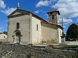 The church of Saint-Paul-lès-Romans | |
Location of Saint-Paul-lès-Romans | |
 Saint-Paul-lès-Romans  Saint-Paul-lès-Romans | |
| Coordinates: 45°04′05″N 5°07′59″E / 45.068°N 5.133°E | |
| Country | France |
| Region | Auvergne-Rhône-Alpes |
| Department | Drôme |
| Arrondissement | Valence |
| Canton | Romans-sur-Isère |
| Intercommunality | CA Valence Romans Agglo |
| Government | |
| • Mayor (2020–2026) | Gérard Lunel[1] |
| Area 1 | 15.77 km2 (6.09 sq mi) |
| Population | 1,893 |
| • Density | 120/km2 (310/sq mi) |
| Time zone | UTC+01:00 (CET) |
| • Summer (DST) | UTC+02:00 (CEST) |
| INSEE/Postal code | 26323 /26750 |
| Elevation | 140–200 m (460–660 ft) (avg. 186 m or 610 ft) |
| 1 French Land Register data, which excludes lakes, ponds, glaciers > 1 km2 (0.386 sq mi or 247 acres) and river estuaries. | |
Saint-Paul-lès-Romans (French pronunciation: [sɛ̃ pɔl lɛ ʁɔmɑ̃], literally Saint-Paul near Romans; Vivaro-Alpine: Sant Pau de Rumans) is a commune in the Drôme department in southeastern France.
Population
| Year | Pop. | ±% p.a. |
|---|---|---|
| 1968 | 865 | — |
| 1975 | 960 | +1.50% |
| 1982 | 1,301 | +4.44% |
| 1990 | 1,401 | +0.93% |
| 1999 | 1,502 | +0.78% |
| 2009 | 1,727 | +1.41% |
| 2014 | 1,806 | +0.90% |
| 2020 | 1,858 | +0.47% |
| Source: INSEE[3] | ||
See also
References
- ↑ "Répertoire national des élus: les maires" (in French). data.gouv.fr, Plateforme ouverte des données publiques françaises. 13 September 2022.
- ↑ "Populations légales 2021". The National Institute of Statistics and Economic Studies. 28 December 2023.
- ↑ Population en historique depuis 1968, INSEE
Wikimedia Commons has media related to Saint-Paul-lès-Romans.
This article is issued from Wikipedia. The text is licensed under Creative Commons - Attribution - Sharealike. Additional terms may apply for the media files.