Saint-Gervais-sur-Roubion | |
|---|---|
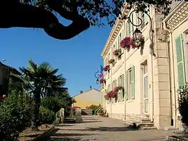 The town hall of Saint-Gervais-sur-Roubion | |
Location of Saint-Gervais-sur-Roubion | |
 Saint-Gervais-sur-Roubion  Saint-Gervais-sur-Roubion | |
| Coordinates: 44°34′59″N 4°53′28″E / 44.583°N 4.891°E | |
| Country | France |
| Region | Auvergne-Rhône-Alpes |
| Department | Drôme |
| Arrondissement | Nyons |
| Canton | Dieulefit |
| Intercommunality | Montélimar Agglomération |
| Government | |
| • Mayor (2020–2026) | Hervé Andéol[1] |
| Area 1 | 14.57 km2 (5.63 sq mi) |
| Population | 1,084 |
| • Density | 74/km2 (190/sq mi) |
| Time zone | UTC+01:00 (CET) |
| • Summer (DST) | UTC+02:00 (CEST) |
| INSEE/Postal code | 26305 /26160 |
| Elevation | 144–233 m (472–764 ft) (avg. 161 m or 528 ft) |
| 1 French Land Register data, which excludes lakes, ponds, glaciers > 1 km2 (0.386 sq mi or 247 acres) and river estuaries. | |
Saint-Gervais-sur-Roubion (French pronunciation: [sɛ̃ ʒɛʁvɛ syʁ ʁubjɔ̃]; Vivaro-Alpine: Sant Gervais de Robion) is a commune in the Drôme department in southeastern France.
Population
| Year | Pop. | ±% p.a. |
|---|---|---|
| 1968 | 620 | — |
| 1975 | 552 | −1.65% |
| 1982 | 594 | +1.05% |
| 1990 | 646 | +1.05% |
| 1999 | 717 | +1.17% |
| 2009 | 796 | +1.05% |
| 2014 | 928 | +3.12% |
| 2020 | 1,083 | +2.61% |
| Source: INSEE[3] | ||
See also
References
- ↑ "Répertoire national des élus: les maires". data.gouv.fr, Plateforme ouverte des données publiques françaises (in French). 2 December 2020.
- ↑ "Populations légales 2021". The National Institute of Statistics and Economic Studies. 28 December 2023.
- ↑ Population en historique depuis 1968, INSEE
Wikimedia Commons has media related to Saint-Gervais-sur-Roubion.
This article is issued from Wikipedia. The text is licensed under Creative Commons - Attribution - Sharealike. Additional terms may apply for the media files.