Charette | |
|---|---|
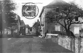 The road into Charette in 1907 | |
Location of Charette | |
 Charette  Charette | |
| Coordinates: 45°48′40″N 5°22′15″E / 45.8111°N 5.3708°E | |
| Country | France |
| Region | Auvergne-Rhône-Alpes |
| Department | Isère |
| Arrondissement | La Tour-du-Pin |
| Canton | Morestel |
| Government | |
| • Mayor (2022–2026) | Francis Maurice Surnon[1] |
| Area 1 | 11.26 km2 (4.35 sq mi) |
| Population | 439 |
| • Density | 39/km2 (100/sq mi) |
| Time zone | UTC+01:00 (CET) |
| • Summer (DST) | UTC+02:00 (CEST) |
| INSEE/Postal code | 38083 /38390 |
| Elevation | 240–350 m (790–1,150 ft) (avg. 248 m or 814 ft) |
| 1 French Land Register data, which excludes lakes, ponds, glaciers > 1 km2 (0.386 sq mi or 247 acres) and river estuaries. | |
Charette (French pronunciation: [ʃaʁɛt]) is a commune in the Isère department in southeastern France.
Population
| Year | Pop. | ±% p.a. |
|---|---|---|
| 1968 | 194 | — |
| 1975 | 189 | −0.37% |
| 1982 | 197 | +0.59% |
| 1990 | 232 | +2.07% |
| 1999 | 281 | +2.15% |
| 2007 | 384 | +3.98% |
| 2012 | 469 | +4.08% |
| 2017 | 459 | −0.43% |
| Source: INSEE[3] | ||
See also
References
- ↑ "Répertoire national des élus: les maires" (in French). data.gouv.fr, Plateforme ouverte des données publiques françaises. 13 September 2022.
- ↑ "Populations légales 2021". The National Institute of Statistics and Economic Studies. 28 December 2023.
- ↑ Population en historique depuis 1968, INSEE
Wikimedia Commons has media related to Charette (Isère).
This article is issued from Wikipedia. The text is licensed under Creative Commons - Attribution - Sharealike. Additional terms may apply for the media files.