Saint-Sorlin-de-Morestel | |
|---|---|
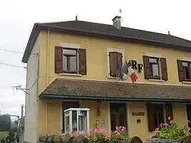 Town hall | |
Location of Saint-Sorlin-de-Morestel | |
 Saint-Sorlin-de-Morestel  Saint-Sorlin-de-Morestel | |
| Coordinates: 45°38′16″N 5°28′38″E / 45.6378°N 5.4772°E | |
| Country | France |
| Region | Auvergne-Rhône-Alpes |
| Department | Isère |
| Arrondissement | La Tour-du-Pin |
| Canton | Morestel |
| Government | |
| • Mayor (2020–2026) | Nicole Genin[1] |
| Area 1 | 5.38 km2 (2.08 sq mi) |
| Population | 603 |
| • Density | 110/km2 (290/sq mi) |
| Time zone | UTC+01:00 (CET) |
| • Summer (DST) | UTC+02:00 (CEST) |
| INSEE/Postal code | 38458 /38510 |
| Elevation | 220–419 m (722–1,375 ft) (avg. 280 m or 920 ft) |
| 1 French Land Register data, which excludes lakes, ponds, glaciers > 1 km2 (0.386 sq mi or 247 acres) and river estuaries. | |
Saint-Sorlin-de-Morestel (French pronunciation: [sɛ̃ sɔʁlɛ̃ də mɔʁɛstɛl], literally Saint-Sorlin of Morestel) is a commune in the Isère department in southeastern France.[3]
Population
| Year | Pop. | ±% p.a. |
|---|---|---|
| 1968 | 338 | — |
| 1975 | 316 | −0.96% |
| 1982 | 388 | +2.98% |
| 1990 | 423 | +1.09% |
| 1999 | 448 | +0.64% |
| 2009 | 546 | +2.00% |
| 2014 | 600 | +1.90% |
| 2020 | 610 | +0.28% |
| Source: INSEE[4] | ||
See also
References
- ↑ "Répertoire national des élus: les maires". data.gouv.fr, Plateforme ouverte des données publiques françaises (in French). 9 August 2021.
- ↑ "Populations légales 2021". The National Institute of Statistics and Economic Studies. 28 December 2023.
- ↑ INSEE commune file
- ↑ Population en historique depuis 1968, INSEE
Wikimedia Commons has media related to Saint-Sorlin-de-Morestel.
This article is issued from Wikipedia. The text is licensed under Creative Commons - Attribution - Sharealike. Additional terms may apply for the media files.