Sainte-Blandine | |
|---|---|
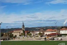 The village centre of Sainte-Blandine | |
Location of Sainte-Blandine | |
 Sainte-Blandine  Sainte-Blandine | |
| Coordinates: 45°32′51″N 5°26′28″E / 45.5475°N 5.4411°E | |
| Country | France |
| Region | Auvergne-Rhône-Alpes |
| Department | Isère |
| Arrondissement | La Tour-du-Pin |
| Canton | La Tour-du-Pin |
| Government | |
| • Mayor (2020–2026) | Jacques Garnier[1] |
| Area 1 | 9.21 km2 (3.56 sq mi) |
| Population | 1,001 |
| • Density | 110/km2 (280/sq mi) |
| Time zone | UTC+01:00 (CET) |
| • Summer (DST) | UTC+02:00 (CEST) |
| INSEE/Postal code | 38369 /38110 |
| Elevation | 328–493 m (1,076–1,617 ft) |
| 1 French Land Register data, which excludes lakes, ponds, glaciers > 1 km2 (0.386 sq mi or 247 acres) and river estuaries. | |
Sainte-Blandine (French pronunciation: [sɛ̃t blɑ̃din]) is a commune in the Isère department in southeastern France.[3]
Population
| Year | Pop. | ±% p.a. |
|---|---|---|
| 1968 | 491 | — |
| 1975 | 482 | −0.26% |
| 1982 | 666 | +4.73% |
| 1990 | 747 | +1.45% |
| 1999 | 764 | +0.25% |
| 2009 | 896 | +1.61% |
| 2014 | 957 | +1.33% |
| 2020 | 983 | +0.45% |
| Source: INSEE[4] | ||
See also
References
Wikimedia Commons has media related to Sainte-Blandine (Isère).
- ↑ "Répertoire national des élus: les maires". data.gouv.fr, Plateforme ouverte des données publiques françaises (in French). 2 December 2020.
- ↑ "Populations légales 2021". The National Institute of Statistics and Economic Studies. 28 December 2023.
- ↑ INSEE commune file
- ↑ Population en historique depuis 1968, INSEE
This article is issued from Wikipedia. The text is licensed under Creative Commons - Attribution - Sharealike. Additional terms may apply for the media files.