Saint-Paul-lès-Monestier | |
|---|---|
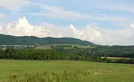 A general view of Saint-Paul-lès-Monestier | |
Location of Saint-Paul-lès-Monestier | |
 Saint-Paul-lès-Monestier  Saint-Paul-lès-Monestier | |
| Coordinates: 44°55′49″N 5°37′42″E / 44.9303°N 5.6283°E | |
| Country | France |
| Region | Auvergne-Rhône-Alpes |
| Department | Isère |
| Arrondissement | Grenoble |
| Canton | Matheysine-Trièves |
| Intercommunality | Trièves |
| Government | |
| • Mayor (2020–2026) | Béatrice Vial[1] |
| Area 1 | 14 km2 (5 sq mi) |
| Population | 279 |
| • Density | 20/km2 (52/sq mi) |
| Time zone | UTC+01:00 (CET) |
| • Summer (DST) | UTC+02:00 (CEST) |
| INSEE/Postal code | 38438 /38650 |
| Elevation | 515–1,800 m (1,690–5,906 ft) (avg. 816 m or 2,677 ft) |
| 1 French Land Register data, which excludes lakes, ponds, glaciers > 1 km2 (0.386 sq mi or 247 acres) and river estuaries. | |
Saint-Paul-lès-Monestier (French pronunciation: [sɛ̃ pɔl lɛ mɔnɛstje], literally Saint-Paul near Monestier) is a commune in the Isère department in southeastern France.[3]
Population
| Year | Pop. | ±% p.a. |
|---|---|---|
| 1968 | 131 | — |
| 1975 | 132 | +0.11% |
| 1982 | 160 | +2.79% |
| 1990 | 190 | +2.17% |
| 1999 | 220 | +1.64% |
| 2009 | 272 | +2.14% |
| 2014 | 252 | −1.52% |
| 2020 | 274 | +1.40% |
| Source: INSEE[4] | ||
See also
References
- ↑ "Répertoire national des élus: les maires" (in French). data.gouv.fr, Plateforme ouverte des données publiques françaises. 13 September 2022.
- ↑ "Populations légales 2021". The National Institute of Statistics and Economic Studies. 28 December 2023.
- ↑ INSEE commune file
- ↑ Population en historique depuis 1968, INSEE
Wikimedia Commons has media related to Saint-Paul-lès-Monestier.
This article is issued from Wikipedia. The text is licensed under Creative Commons - Attribution - Sharealike. Additional terms may apply for the media files.