Saint-Ondras | |
|---|---|
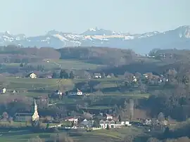 A general view of Saint-Ondras | |
Location of Saint-Ondras | |
 Saint-Ondras  Saint-Ondras | |
| Coordinates: 45°31′07″N 5°32′52″E / 45.5186°N 5.5478°E | |
| Country | France |
| Region | Auvergne-Rhône-Alpes |
| Department | Isère |
| Arrondissement | La Tour-du-Pin |
| Canton | Le Grand-Lemps |
| Government | |
| • Mayor (2022–2026) | Michel Cleyet-Merle[1] |
| Area 1 | 8.15 km2 (3.15 sq mi) |
| Population | 655 |
| • Density | 80/km2 (210/sq mi) |
| Time zone | UTC+01:00 (CET) |
| • Summer (DST) | UTC+02:00 (CEST) |
| INSEE/Postal code | 38434 /38490 |
| Elevation | 361–626 m (1,184–2,054 ft) (avg. 410 m or 1,350 ft) |
| 1 French Land Register data, which excludes lakes, ponds, glaciers > 1 km2 (0.386 sq mi or 247 acres) and river estuaries. | |
Saint-Ondras is a commune in the Isère department in southeastern France.[3]
Population
| Year | Pop. | ±% p.a. |
|---|---|---|
| 1968 | 336 | — |
| 1975 | 307 | −1.28% |
| 1982 | 362 | +2.38% |
| 1990 | 478 | +3.54% |
| 1999 | 496 | +0.41% |
| 2009 | 589 | +1.73% |
| 2014 | 610 | +0.70% |
| 2020 | 650 | +1.06% |
| Source: INSEE[4] | ||
Geography
The Bourbre forms the commune's northwestern border.
See also
References
Wikimedia Commons has media related to Saint-Ondras.
- ↑ "Répertoire national des élus: les maires" (in French). data.gouv.fr, Plateforme ouverte des données publiques françaises. 13 September 2022.
- ↑ "Populations légales 2021". The National Institute of Statistics and Economic Studies. 28 December 2023.
- ↑ INSEE commune file
- ↑ Population en historique depuis 1968, INSEE
This article is issued from Wikipedia. The text is licensed under Creative Commons - Attribution - Sharealike. Additional terms may apply for the media files.