Écurie | |
|---|---|
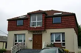 The town hall of Écurie | |
.svg.png.webp) Coat of arms | |
Location of Écurie | |
 Écurie  Écurie | |
| Coordinates: 50°19′50″N 2°46′13″E / 50.3306°N 2.7703°E / 50.3306; 2.7703 | |
| Country | France |
| Region | Hauts-de-France |
| Department | Pas-de-Calais |
| Arrondissement | Arras |
| Canton | Arras-1 |
| Intercommunality | CU Arras |
| Government | |
| • Mayor (2020–2026) | Charline Caillierez[1] |
| Area 1 | 2.99 km2 (1.15 sq mi) |
| Population | 378 |
| • Density | 130/km2 (330/sq mi) |
| Time zone | UTC+01:00 (CET) |
| • Summer (DST) | UTC+02:00 (CEST) |
| INSEE/Postal code | 62290 /62223 |
| Elevation | 85–106 m (279–348 ft) (avg. 104 m or 341 ft) |
| 1 French Land Register data, which excludes lakes, ponds, glaciers > 1 km2 (0.386 sq mi or 247 acres) and river estuaries. | |
Écurie (French pronunciation: [ekyʁi] ⓘ) is a commune in the Pas-de-Calais department in the Hauts-de-France region of France.[3]
Geography
A farming village situated 3 miles (4.8 km) north of Arras at the junction of the N17 and D60 roads.
Population
| Year | Pop. | ±% p.a. |
|---|---|---|
| 1968 | 235 | — |
| 1975 | 299 | +3.50% |
| 1982 | 278 | −1.03% |
| 1990 | 268 | −0.46% |
| 1999 | 297 | +1.15% |
| 2007 | 399 | +3.76% |
| 2012 | 400 | +0.05% |
| 2017 | 386 | −0.71% |
| Source: INSEE[4] | ||
Places of interest
- The church of St.Séverin, rebuilt, as was most of the village, after World War I.
See also
References
- ↑ "Répertoire national des élus: les maires". data.gouv.fr, Plateforme ouverte des données publiques françaises (in French). 9 August 2021.
- ↑ "Populations légales 2021". The National Institute of Statistics and Economic Studies. 28 December 2023.
- ↑ INSEE commune file
- ↑ Population en historique depuis 1968, INSEE
Wikimedia Commons has media related to Écurie.
This article is issued from Wikipedia. The text is licensed under Creative Commons - Attribution - Sharealike. Additional terms may apply for the media files.