Rémy | |
|---|---|
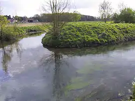 The Sensée | |
 Coat of arms | |
Location of Rémy | |
 Rémy  Rémy | |
| Coordinates: 50°15′16″N 2°57′24″E / 50.2544°N 2.9567°E | |
| Country | France |
| Region | Hauts-de-France |
| Department | Pas-de-Calais |
| Arrondissement | Arras |
| Canton | Brebières |
| Intercommunality | CC Osartis Marquion |
| Government | |
| • Mayor (2020–2026) | Annick Danel[1] |
| Area 1 | 3.59 km2 (1.39 sq mi) |
| Population | 383 |
| • Density | 110/km2 (280/sq mi) |
| Time zone | UTC+01:00 (CET) |
| • Summer (DST) | UTC+02:00 (CEST) |
| INSEE/Postal code | 62703 /62156 |
| Elevation | 42–71 m (138–233 ft) (avg. 45 m or 148 ft) |
| 1 French Land Register data, which excludes lakes, ponds, glaciers > 1 km2 (0.386 sq mi or 247 acres) and river estuaries. | |
Rémy (French pronunciation: [ʁemi]; Picard: R’my) is a commune in the department of Pas-de-Calais in the Hauts-de-France region of France.[3]
Geography
Rémy lies in the valley of the river Sensée, some 10 miles (16 km) southeast of Arras, on the D9 road.
Population
| Year | Pop. | ±% p.a. |
|---|---|---|
| 1968 | 151 | — |
| 1975 | 178 | +2.38% |
| 1982 | 213 | +2.60% |
| 1990 | 254 | +2.22% |
| 1999 | 265 | +0.47% |
| 2007 | 242 | −1.13% |
| 2012 | 280 | +2.96% |
| 2017 | 395 | +7.12% |
| Source: INSEE[4] | ||
Places of interest
- The church of St-Léger, rebuilt, along with the rest of the village, after the First World War.
- A watermill.
See also
References
- ↑ "Répertoire national des élus: les maires". data.gouv.fr, Plateforme ouverte des données publiques françaises (in French). 2 December 2020.
- ↑ "Populations légales 2021". The National Institute of Statistics and Economic Studies. 28 December 2023.
- ↑ INSEE commune file
- ↑ Population en historique depuis 1968, INSEE
Wikimedia Commons has media related to Rémy (Pas-de-Calais).
This article is issued from Wikipedia. The text is licensed under Creative Commons - Attribution - Sharealike. Additional terms may apply for the media files.