Étrun
Stroom | |
|---|---|
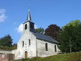 The church of Étrun | |
 Coat of arms | |
Location of Étrun | |
 Étrun  Étrun | |
| Coordinates: 50°18′54″N 2°42′07″E / 50.315°N 2.7019°E | |
| Country | France |
| Region | Hauts-de-France |
| Department | Pas-de-Calais |
| Arrondissement | Arras |
| Canton | Arras-1 |
| Intercommunality | CU Arras |
| Government | |
| • Mayor (2020–2026) | Michel Mathissart[1] |
| Area 1 | 2.22 km2 (0.86 sq mi) |
| Population | 321 |
| • Density | 140/km2 (370/sq mi) |
| Time zone | UTC+01:00 (CET) |
| • Summer (DST) | UTC+02:00 (CEST) |
| INSEE/Postal code | 62320 /62161 |
| Elevation | 58–107 m (190–351 ft) (avg. 153 m or 502 ft) |
| 1 French Land Register data, which excludes lakes, ponds, glaciers > 1 km2 (0.386 sq mi or 247 acres) and river estuaries. | |
Étrun (French pronunciation: [etʁœ̃]; West Flemish: Stroom) is a commune in the Pas-de-Calais department in the Hauts-de-France region of France.[3]
Geography
A farming village situated 4 miles (6.4 km) northwest of Arras, at the junction of the N39 and the D55 roads. The river Gy flows through the commune.
Population
| Year | Pop. | ±% p.a. |
|---|---|---|
| 1968 | 414 | — |
| 1975 | 367 | −1.71% |
| 1982 | 302 | −2.75% |
| 1990 | 336 | +1.34% |
| 1999 | 326 | −0.34% |
| 2007 | 328 | +0.08% |
| 2012 | 331 | +0.18% |
| 2017 | 314 | −1.05% |
| Source: INSEE[4] | ||
Places of interest
- The church of St.Nicholas, dating from the seventeenth century.
- The Duisans British Cemetery, a WW-I Commonwealth War Graves Commission cemetery.
- The remnants of an old chateau.
See also
References
- ↑ "Répertoire national des élus: les maires". data.gouv.fr, Plateforme ouverte des données publiques françaises (in French). 2 December 2020.
- ↑ "Populations légales 2021". The National Institute of Statistics and Economic Studies. 28 December 2023.
- ↑ INSEE commune file
- ↑ Population en historique depuis 1968, INSEE
External links
Wikimedia Commons has media related to Étrun.
This article is issued from Wikipedia. The text is licensed under Creative Commons - Attribution - Sharealike. Additional terms may apply for the media files.