Séricourt | |
|---|---|
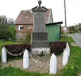 The monument to the dead of Séricourt | |
Location of Séricourt | |
 Séricourt  Séricourt | |
| Coordinates: 50°17′45″N 2°18′56″E / 50.2958°N 2.3156°E | |
| Country | France |
| Region | Hauts-de-France |
| Department | Pas-de-Calais |
| Arrondissement | Arras |
| Canton | Saint-Pol-sur-Ternoise |
| Intercommunality | CC Ternois |
| Government | |
| • Mayor (2020–2026) | Sylvain Ducroquet[1] |
| Area 1 | 2.45 km2 (0.95 sq mi) |
| Population | 48 |
| • Density | 20/km2 (51/sq mi) |
| Time zone | UTC+01:00 (CET) |
| • Summer (DST) | UTC+02:00 (CEST) |
| INSEE/Postal code | 62791 /62270 |
| Elevation | 79–145 m (259–476 ft) (avg. 83 m or 272 ft) |
| 1 French Land Register data, which excludes lakes, ponds, glaciers > 1 km2 (0.386 sq mi or 247 acres) and river estuaries. | |
Séricourt (French pronunciation: [seʁikuʁ]) is a commune in the Pas-de-Calais department in the Hauts-de-France region of France.[3]
Geography
Séricourt lies 25 miles (40 km) west of Arras, at the junction of the D82 and D104 roads.
Population
| Year | Pop. | ±% p.a. |
|---|---|---|
| 1968 | 39 | — |
| 1975 | 48 | +3.01% |
| 1982 | 47 | −0.30% |
| 1990 | 53 | +1.51% |
| 1999 | 60 | +1.39% |
| 2007 | 52 | −1.77% |
| 2012 | 53 | +0.38% |
| 2017 | 54 | +0.37% |
| Source: INSEE[4] | ||
Places of interest
- The church of St.Martin, dating from the sixteenth century.
- A restored farmhouse, containing elements of the old priory of Gouy.
See also
References
- ↑ "Répertoire national des élus: les maires". data.gouv.fr, Plateforme ouverte des données publiques françaises (in French). 9 August 2021.
- ↑ "Populations légales 2021". The National Institute of Statistics and Economic Studies. 28 December 2023.
- ↑ INSEE commune file
- ↑ Population en historique depuis 1968, INSEE
Wikimedia Commons has media related to Séricourt.
This article is issued from Wikipedia. The text is licensed under Creative Commons - Attribution - Sharealike. Additional terms may apply for the media files.