Bouret-sur-Canche | |
|---|---|
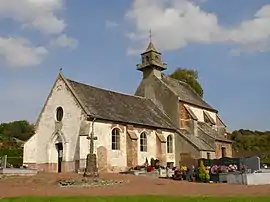 The church of Bouret-sur-Canche | |
 Coat of arms | |
Location of Bouret-sur-Canche | |
 Bouret-sur-Canche  Bouret-sur-Canche | |
| Coordinates: 50°16′11″N 2°19′30″E / 50.2697°N 2.325°E | |
| Country | France |
| Region | Hauts-de-France |
| Department | Pas-de-Calais |
| Arrondissement | Arras |
| Canton | Saint-Pol-sur-Ternoise |
| Intercommunality | CC Ternois |
| Government | |
| • Mayor (2020–2026) | Jean-Marie Delattre[1] |
| Area 1 | 4.87 km2 (1.88 sq mi) |
| Population | 248 |
| • Density | 51/km2 (130/sq mi) |
| Time zone | UTC+01:00 (CET) |
| • Summer (DST) | UTC+02:00 (CEST) |
| INSEE/Postal code | 62163 /62270 |
| Elevation | 68–147 m (223–482 ft) (avg. 76 m or 249 ft) |
| 1 French Land Register data, which excludes lakes, ponds, glaciers > 1 km2 (0.386 sq mi or 247 acres) and river estuaries. | |
Bouret-sur-Canche (French pronunciation: [buʁɛ syʁ kɑ̃ʃ], literally Bouret on Canche; Picard: Bouret-su-Canche) is a commune in the Pas-de-Calais department in the Hauts-de-France region in northern France.[3]
Geography
A farming village located 20 miles (32 km) west of Arras on the D329 road, by the banks of the river Canche.
Population
| Year | Pop. | ±% |
|---|---|---|
| 1962 | 171 | — |
| 1968 | 181 | +5.8% |
| 1975 | 186 | +2.8% |
| 1982 | 198 | +6.5% |
| 1990 | 194 | −2.0% |
| 1999 | 207 | +6.7% |
| 2009 | 245 | +18.4% |
Sights
- The church of St. Vaast, dating from the eighteenth century.
- An eighteenth-century chapel.
See also
References
- ↑ "Répertoire national des élus: les maires". data.gouv.fr, Plateforme ouverte des données publiques françaises (in French). 2 December 2020.
- ↑ "Populations légales 2021". The National Institute of Statistics and Economic Studies. 28 December 2023.
- ↑ INSEE commune file
Wikimedia Commons has media related to Bouret-sur-Canche.
This article is issued from Wikipedia. The text is licensed under Creative Commons - Attribution - Sharealike. Additional terms may apply for the media files.