Oppy | |
|---|---|
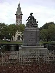 The monument to the dead of Oppy | |
 Coat of arms | |
Location of Oppy | |
 Oppy  Oppy | |
| Coordinates: 50°20′54″N 2°53′30″E / 50.3483°N 2.8917°E | |
| Country | France |
| Region | Hauts-de-France |
| Department | Pas-de-Calais |
| Arrondissement | Arras |
| Canton | Brebières |
| Intercommunality | CC Osartis Marquion |
| Government | |
| • Mayor (2020–2026) | Xavier Platel[1] |
| Area 1 | 4.84 km2 (1.87 sq mi) |
| Population | 379 |
| • Density | 78/km2 (200/sq mi) |
| Time zone | UTC+01:00 (CET) |
| • Summer (DST) | UTC+02:00 (CEST) |
| INSEE/Postal code | 62639 /62580 |
| Elevation | 49–72 m (161–236 ft) (avg. 59 m or 194 ft) |
| 1 French Land Register data, which excludes lakes, ponds, glaciers > 1 km2 (0.386 sq mi or 247 acres) and river estuaries. | |
Oppy (French pronunciation: [ɔpi]) is a commune in the Pas-de-Calais department in the Hauts-de-France region of France.[3]
Geography
Oppy is situated 7 miles (11 km) northeast of Arras, at the junction of the D33, D48 and D50 roads.
Population
| Year | Pop. | ±% p.a. |
|---|---|---|
| 1968 | 278 | — |
| 1975 | 292 | +0.70% |
| 1982 | 282 | −0.50% |
| 1990 | 329 | +1.95% |
| 1999 | 375 | +1.46% |
| 2007 | 383 | +0.26% |
| 2012 | 373 | −0.53% |
| 2017 | 399 | +1.36% |
| Source: INSEE[4] | ||
Places of interest
- The church of St.Nicholas, rebuilt along with the rest of the village, after World War I.
- Traces of an old chateau.
- Two war memorials
See also
References
- ↑ "Répertoire national des élus: les maires". data.gouv.fr, Plateforme ouverte des données publiques françaises (in French). 2 December 2020.
- ↑ "Populations légales 2021". The National Institute of Statistics and Economic Studies. 28 December 2023.
- ↑ INSEE commune file
- ↑ Population en historique depuis 1968, INSEE
Wikimedia Commons has media related to Oppy.
This article is issued from Wikipedia. The text is licensed under Creative Commons - Attribution - Sharealike. Additional terms may apply for the media files.