Bergueneuse | |
|---|---|
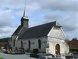 The church of Bergueneuse | |
 Coat of arms | |
Location of Bergueneuse | |
 Bergueneuse  Bergueneuse | |
| Coordinates: 50°28′09″N 2°15′15″E / 50.4692°N 2.2542°E / 50.4692; 2.2542 | |
| Country | France |
| Region | Hauts-de-France |
| Department | Pas-de-Calais |
| Arrondissement | Arras |
| Canton | Saint-Pol-sur-Ternoise |
| Intercommunality | CC du Ternois |
| Government | |
| • Mayor (2020–2026) | Christopher Beharelle[1] |
| Area 1 | 2.78 km2 (1.07 sq mi) |
| Population | 217 |
| • Density | 78/km2 (200/sq mi) |
| Time zone | UTC+01:00 (CET) |
| • Summer (DST) | UTC+02:00 (CEST) |
| INSEE/Postal code | 62109 /62134 |
| Elevation | 64–132 m (210–433 ft) (avg. 130 m or 430 ft) |
| 1 French Land Register data, which excludes lakes, ponds, glaciers > 1 km2 (0.386 sq mi or 247 acres) and river estuaries. | |
Bergueneuse (French pronunciation: [bɛʁɡənøz]; Picard: Berguigneu) is a commune in the Pas-de-Calais department in the Hauts-de-France region in northern France.[3]
Geography
Bergueneuse consists of a village located 28 miles (42 km) northwest of Arras at the D94 and D71 road junction.
Population
| Year | Pop. | ±% |
|---|---|---|
| 1962 | 220 | — |
| 1968 | 226 | +2.7% |
| 1975 | 252 | +11.5% |
| 1982 | 243 | −3.6% |
| 1990 | 239 | −1.6% |
| 1999 | 241 | +0.8% |
| 2006 | 220 | −8.7% |
| 2009 | 214 | −2.7% |
| 2011 | 208 | −2.8% |
| 2015 | 213 | +2.4% |
Sights
- The seventeenth-century church.
See also
References
- ↑ "Répertoire national des élus: les maires". data.gouv.fr, Plateforme ouverte des données publiques françaises (in French). 9 August 2021.
- ↑ "Populations légales 2021". The National Institute of Statistics and Economic Studies. 28 December 2023.
- ↑ INSEE commune file
Wikimedia Commons has media related to Bergueneuse.
This article is issued from Wikipedia. The text is licensed under Creative Commons - Attribution - Sharealike. Additional terms may apply for the media files.