Fins | |
|---|---|
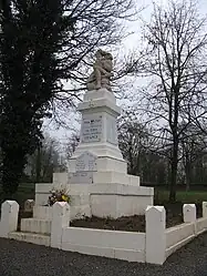 The war memorial in Fins | |
Location of Fins | |
 Fins  Fins | |
| Coordinates: 50°02′08″N 3°02′34″E / 50.0356°N 3.0428°E | |
| Country | France |
| Region | Hauts-de-France |
| Department | Somme |
| Arrondissement | Péronne |
| Canton | Péronne |
| Intercommunality | Haute Somme |
| Government | |
| • Mayor (2020–2026) | Daniel Decodts[1] |
| Area 1 | 6.87 km2 (2.65 sq mi) |
| Population | 279 |
| • Density | 41/km2 (110/sq mi) |
| Time zone | UTC+01:00 (CET) |
| • Summer (DST) | UTC+02:00 (CEST) |
| INSEE/Postal code | 80312 /80360 |
| Elevation | 93–138 m (305–453 ft) (avg. 103 m or 338 ft) |
| 1 French Land Register data, which excludes lakes, ponds, glaciers > 1 km2 (0.386 sq mi or 247 acres) and river estuaries. | |
Fins is a commune in the Somme department in Hauts-de-France in northern France.
Geography
Fins is situated on the D917 and D58 crossroads, near the border with the Pas-de-Calais département, some 20 miles (32 km) northwest of Saint-Quentin.
Population
| Year | Pop. | ±% p.a. |
|---|---|---|
| 1968 | 313 | — |
| 1975 | 296 | −0.79% |
| 1982 | 258 | −1.94% |
| 1990 | 243 | −0.75% |
| 1999 | 257 | +0.62% |
| 2007 | 270 | +0.62% |
| 2012 | 286 | +1.16% |
| 2017 | 277 | −0.64% |
| Source: INSEE[3] | ||
See also
References
- ↑ "Répertoire national des élus: les maires" (in French). data.gouv.fr, Plateforme ouverte des données publiques françaises. 13 September 2022.
- ↑ "Populations légales 2021". The National Institute of Statistics and Economic Studies. 28 December 2023.
- ↑ Population en historique depuis 1968, INSEE
Wikimedia Commons has media related to Fins.
This article is issued from Wikipedia. The text is licensed under Creative Commons - Attribution - Sharealike. Additional terms may apply for the media files.