Villers-sous-Ailly | |
|---|---|
.JPG.webp) The town hall and school in Villers-sous-Ailly | |
Location of Villers-sous-Ailly | |
 Villers-sous-Ailly  Villers-sous-Ailly | |
| Coordinates: 50°03′44″N 2°01′03″E / 50.0622°N 2.0175°E | |
| Country | France |
| Region | Hauts-de-France |
| Department | Somme |
| Arrondissement | Abbeville |
| Canton | Rue |
| Intercommunality | CC Ponthieu-Marquenterre |
| Government | |
| • Mayor (2020–2026) | Laurent Sauvage[1] |
| Area 1 | 6.26 km2 (2.42 sq mi) |
| Population | 182 |
| • Density | 29/km2 (75/sq mi) |
| Time zone | UTC+01:00 (CET) |
| • Summer (DST) | UTC+02:00 (CEST) |
| INSEE/Postal code | 80804 /80690 |
| Elevation | 40–112 m (131–367 ft) (avg. 80 m or 260 ft) |
| 1 French Land Register data, which excludes lakes, ponds, glaciers > 1 km2 (0.386 sq mi or 247 acres) and river estuaries. | |
Villers-sous-Ailly (French pronunciation: [vilɛʁ su.z‿aji], literally Villers under Ailly) is a commune in the Somme department in Hauts-de-France in northern France.
Geography
The commune is situated 8 miles(12 km) southeast of Abbeville, on the D237 road.
Population
| Year | Pop. | ±% p.a. |
|---|---|---|
| 1968 | 143 | — |
| 1975 | 109 | −3.80% |
| 1982 | 122 | +1.62% |
| 1990 | 146 | +2.27% |
| 1999 | 146 | +0.00% |
| 2007 | 180 | +2.65% |
| 2012 | 189 | +0.98% |
| 2017 | 181 | −0.86% |
| Source: INSEE[3] | ||
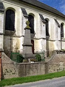
The war memorial next to the church
See also
References
- ↑ "Répertoire national des élus: les maires" (in French). data.gouv.fr, Plateforme ouverte des données publiques françaises. 13 September 2022.
- ↑ "Populations légales 2021". The National Institute of Statistics and Economic Studies. 28 December 2023.
- ↑ Population en historique depuis 1968, INSEE
Wikimedia Commons has media related to Villers-sous-Ailly.
This article is issued from Wikipedia. The text is licensed under Creative Commons - Attribution - Sharealike. Additional terms may apply for the media files.