Fransu | |
|---|---|
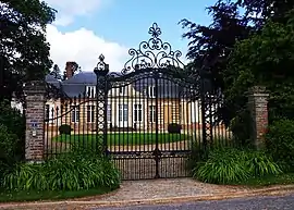 The chateau in Fransu | |
Location of Fransu | |
 Fransu  Fransu | |
| Coordinates: 50°06′37″N 2°05′39″E / 50.1103°N 2.0942°E | |
| Country | France |
| Region | Hauts-de-France |
| Department | Somme |
| Arrondissement | Amiens |
| Canton | Flixecourt |
| Intercommunality | CC Nièvre et Somme |
| Government | |
| • Mayor (2020–2026) | Philippe Mauger[1] |
| Area 1 | 5.64 km2 (2.18 sq mi) |
| Population | 188 |
| • Density | 33/km2 (86/sq mi) |
| Time zone | UTC+01:00 (CET) |
| • Summer (DST) | UTC+02:00 (CEST) |
| INSEE/Postal code | 80348 /80620 |
| Elevation | 67–122 m (220–400 ft) (avg. 113 m or 371 ft) |
| 1 French Land Register data, which excludes lakes, ponds, glaciers > 1 km2 (0.386 sq mi or 247 acres) and river estuaries. | |
Fransu (French pronunciation: [fʁɑ̃sy]) is a commune in the Somme department in Hauts-de-France in northern France.
Geography
Fransu is situated 16 miles (26 km) east of Abbeville on the D130 and D66 road junction
Population
| Year | Pop. | ±% p.a. |
|---|---|---|
| 1968 | 148 | — |
| 1975 | 139 | −0.89% |
| 1982 | 117 | −2.43% |
| 1990 | 126 | +0.93% |
| 1999 | 104 | −2.11% |
| 2007 | 119 | +1.70% |
| 2012 | 153 | +5.15% |
| 2017 | 176 | +2.84% |
| Source: INSEE[3] | ||
See also
References
- ↑ "Répertoire national des élus: les maires". data.gouv.fr, Plateforme ouverte des données publiques françaises (in French). 2 December 2020.
- ↑ "Populations légales 2021". The National Institute of Statistics and Economic Studies. 28 December 2023.
- ↑ Population en historique depuis 1968, INSEE
External links
Wikimedia Commons has media related to Fransu.
- Fransu on the Quid website (in French)
This article is issued from Wikipedia. The text is licensed under Creative Commons - Attribution - Sharealike. Additional terms may apply for the media files.