Matigny | |
|---|---|
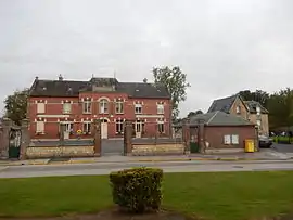 The town hall in Matigny | |
Location of Matigny | |
 Matigny  Matigny | |
| Coordinates: 49°47′46″N 3°00′32″E / 49.7961°N 3.0089°E | |
| Country | France |
| Region | Hauts-de-France |
| Department | Somme |
| Arrondissement | Péronne |
| Canton | Ham |
| Intercommunality | CC Est de la Somme |
| Government | |
| • Mayor (2020–2026) | Marie-Elisabeth Cartigny[1] |
| Area 1 | 6.99 km2 (2.70 sq mi) |
| Population | 492 |
| • Density | 70/km2 (180/sq mi) |
| Time zone | UTC+01:00 (CET) |
| • Summer (DST) | UTC+02:00 (CEST) |
| INSEE/Postal code | 80519 /80400 |
| Elevation | 57–82 m (187–269 ft) (avg. 74 m or 243 ft) |
| 1 French Land Register data, which excludes lakes, ponds, glaciers > 1 km2 (0.386 sq mi or 247 acres) and river estuaries. | |
Matigny (French pronunciation: [matiɲi]) is a commune in the Somme department in Hauts-de-France in northern France.
Geography
Matigny is situated on the D937 road, some 15 miles (24 km) west of Saint-Quentin.
Population
| Year | Pop. | ±% p.a. |
|---|---|---|
| 1968 | 557 | — |
| 1975 | 538 | −0.49% |
| 1982 | 514 | −0.65% |
| 1990 | 504 | −0.25% |
| 1999 | 511 | +0.15% |
| 2007 | 508 | −0.07% |
| 2012 | 517 | +0.35% |
| 2017 | 503 | −0.55% |
| Source: INSEE[3] | ||
See also
References
- ↑ "Répertoire national des élus: les maires". data.gouv.fr, Plateforme ouverte des données publiques françaises (in French). 2 December 2020.
- ↑ "Populations légales 2021". The National Institute of Statistics and Economic Studies. 28 December 2023.
- ↑ Population en historique depuis 1968, INSEE
Wikimedia Commons has media related to Matigny.
This article is issued from Wikipedia. The text is licensed under Creative Commons - Attribution - Sharealike. Additional terms may apply for the media files.