Frettemeule | |
|---|---|
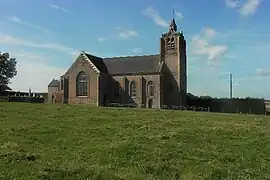 The church in Frettemeule | |
.svg.png.webp) Coat of arms | |
Location of Frettemeule | |
 Frettemeule  Frettemeule | |
| Coordinates: 50°00′43″N 1°38′36″E / 50.0119°N 1.6433°E | |
| Country | France |
| Region | Hauts-de-France |
| Department | Somme |
| Arrondissement | Abbeville |
| Canton | Gamaches |
| Intercommunality | CC Aumale - Blangy-sur-Bresle |
| Government | |
| • Mayor (2020–2026) | Jean-Claude Brailly[1] |
| Area 1 | 7.45 km2 (2.88 sq mi) |
| Population | 296 |
| • Density | 40/km2 (100/sq mi) |
| Time zone | UTC+01:00 (CET) |
| • Summer (DST) | UTC+02:00 (CEST) |
| INSEE/Postal code | 80362 /80220 |
| Elevation | 61–127 m (200–417 ft) (avg. 90 m or 300 ft) |
| 1 French Land Register data, which excludes lakes, ponds, glaciers > 1 km2 (0.386 sq mi or 247 acres) and river estuaries. | |
Frettemeule (French pronunciation: [fʁɛtmøl]; Picard: Frécmole) is a commune in the Somme department in Hauts-de-France in northern France.
Geography
Frettemeule is situated on the D190 road, some 21 km (13 mi) southwest of Abbeville.
Population
| Year | Pop. | ±% p.a. |
|---|---|---|
| 1968 | 344 | — |
| 1975 | 321 | −0.98% |
| 1982 | 318 | −0.13% |
| 1990 | 312 | −0.24% |
| 1999 | 238 | −2.96% |
| 2007 | 266 | +1.40% |
| 2012 | 293 | +1.95% |
| 2017 | 324 | +2.03% |
| Source: INSEE[3] | ||
See also
References
- ↑ "Répertoire national des élus: les maires". data.gouv.fr, Plateforme ouverte des données publiques françaises (in French). 2 December 2020.
- ↑ "Populations légales 2021". The National Institute of Statistics and Economic Studies. 28 December 2023.
- ↑ Population en historique depuis 1968, INSEE
Wikimedia Commons has media related to Frettemeule.
This article is issued from Wikipedia. The text is licensed under Creative Commons - Attribution - Sharealike. Additional terms may apply for the media files.