Longavesnes | |
|---|---|
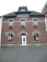 The town hall in Longavesnes | |
 Coat of arms | |
Location of Longavesnes | |
 Longavesnes  Longavesnes | |
| Coordinates: 49°58′18″N 3°03′37″E / 49.9717°N 3.0603°E | |
| Country | France |
| Region | Hauts-de-France |
| Department | Somme |
| Arrondissement | Péronne |
| Canton | Péronne |
| Intercommunality | Haute Somme |
| Government | |
| • Mayor (2020–2026) | Xavier Wauters[1] |
| Area 1 | 4.09 km2 (1.58 sq mi) |
| Population | 73 |
| • Density | 18/km2 (46/sq mi) |
| Time zone | UTC+01:00 (CET) |
| • Summer (DST) | UTC+02:00 (CEST) |
| INSEE/Postal code | 80487 /80240 |
| Elevation | 94–144 m (308–472 ft) (avg. 100 m or 330 ft) |
| 1 French Land Register data, which excludes lakes, ponds, glaciers > 1 km2 (0.386 sq mi or 247 acres) and river estuaries. | |
Longavesnes (French pronunciation: [lɔ̃ɡavɛn]) is a commune in the Somme department in Hauts-de-France in northern France.
Geography
Longavesnes is situated 13 miles (21 km) northwest of Saint-Quentin, in the northeast corner of the department, on the D101 road.
Population
| Year | Pop. | ±% p.a. |
|---|---|---|
| 1968 | 138 | — |
| 1975 | 136 | −0.21% |
| 1982 | 108 | −3.24% |
| 1990 | 110 | +0.23% |
| 1999 | 104 | −0.62% |
| 2007 | 100 | −0.49% |
| 2012 | 84 | −3.43% |
| 2017 | 86 | +0.47% |
| Source: INSEE[3] | ||
See also
References
- ↑ "Répertoire national des élus: les maires". data.gouv.fr, Plateforme ouverte des données publiques françaises (in French). 2 December 2020.
- ↑ "Populations légales 2021". The National Institute of Statistics and Economic Studies. 28 December 2023.
- ↑ Population en historique depuis 1968, INSEE
Wikimedia Commons has media related to Longavesnes.
This article is issued from Wikipedia. The text is licensed under Creative Commons - Attribution - Sharealike. Additional terms may apply for the media files.