Senlis-le-Sec | |
|---|---|
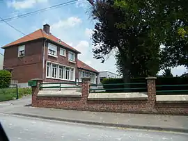 The school in Senlis-le-Sec | |
Location of Senlis-le-Sec | |
 Senlis-le-Sec  Senlis-le-Sec | |
| Coordinates: 50°01′33″N 2°35′21″E / 50.0258°N 2.5892°E | |
| Country | France |
| Region | Hauts-de-France |
| Department | Somme |
| Arrondissement | Péronne |
| Canton | Albert |
| Intercommunality | Pays du Coquelicot |
| Government | |
| • Mayor (2020–2026) | Geneviève Lebailly[1] |
| Area 1 | 8.28 km2 (3.20 sq mi) |
| Population | 317 |
| • Density | 38/km2 (99/sq mi) |
| Time zone | UTC+01:00 (CET) |
| • Summer (DST) | UTC+02:00 (CEST) |
| INSEE/Postal code | 80733 /80300 |
| Elevation | 72–137 m (236–449 ft) (avg. 92 m or 302 ft) |
| 1 French Land Register data, which excludes lakes, ponds, glaciers > 1 km2 (0.386 sq mi or 247 acres) and river estuaries. | |
Senlis-le-Sec is a commune in the Somme department in Hauts-de-France in northern France.
Geography
The commune is situated 15 miles (24 km) northeast of Amiens, on the D119 road
Population
| Year | Pop. | ±% p.a. |
|---|---|---|
| 1968 | 263 | — |
| 1975 | 258 | −0.27% |
| 1982 | 265 | +0.38% |
| 1990 | 272 | +0.33% |
| 1999 | 302 | +1.17% |
| 2007 | 285 | −0.72% |
| 2012 | 285 | +0.00% |
| 2017 | 294 | +0.62% |
| Source: INSEE[3] | ||
See also
References
- ↑ "Répertoire national des élus: les maires". data.gouv.fr, Plateforme ouverte des données publiques françaises (in French). 2 December 2020.
- ↑ "Populations légales 2021". The National Institute of Statistics and Economic Studies. 28 December 2023.
- ↑ Population en historique depuis 1968, INSEE
Wikimedia Commons has media related to Senlis-le-Sec.
This article is issued from Wikipedia. The text is licensed under Creative Commons - Attribution - Sharealike. Additional terms may apply for the media files.