Puchevillers | |
|---|---|
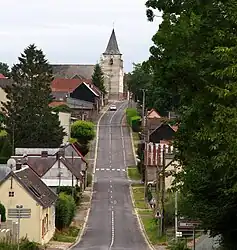 The main road in Puchevillers | |
Location of Puchevillers | |
 Puchevillers  Puchevillers | |
| Coordinates: 50°03′21″N 2°24′40″E / 50.055833°N 2.411°E | |
| Country | France |
| Region | Hauts-de-France |
| Department | Somme |
| Arrondissement | Péronne |
| Canton | Albert |
| Intercommunality | Pays du Coquelicot |
| Government | |
| • Mayor (2020–2026) | Pascal Dekydtspotter[1] |
| Area 1 | 14.24 km2 (5.50 sq mi) |
| Population | 555 |
| • Density | 39/km2 (100/sq mi) |
| Time zone | UTC+01:00 (CET) |
| • Summer (DST) | UTC+02:00 (CEST) |
| INSEE/Postal code | 80645 /80560 |
| Elevation | 77–151 m (253–495 ft) (avg. 135 m or 443 ft) |
| 1 French Land Register data, which excludes lakes, ponds, glaciers > 1 km2 (0.386 sq mi or 247 acres) and river estuaries. | |
Puchevillers is a commune in the Somme department in Hauts-de-France in northern France.
Geography
Puchevillers is situated on the D11 and D23 crossroads, some 13 miles (21 km) north of Amiens.
Population
| Year | Pop. | ±% p.a. |
|---|---|---|
| 1968 | 438 | — |
| 1975 | 395 | −1.47% |
| 1982 | 424 | +1.02% |
| 1990 | 483 | +1.64% |
| 1999 | 487 | +0.09% |
| 2007 | 502 | +0.38% |
| 2012 | 532 | +1.17% |
| 2017 | 555 | +0.85% |
| Source: INSEE[3] | ||
See also
References
- ↑ "Répertoire national des élus: les maires". data.gouv.fr, Plateforme ouverte des données publiques françaises (in French). 2 December 2020.
- ↑ "Populations légales 2021". The National Institute of Statistics and Economic Studies. 28 December 2023.
- ↑ Population en historique depuis 1968, INSEE
Wikimedia Commons has media related to Puchevillers.
This article is issued from Wikipedia. The text is licensed under Creative Commons - Attribution - Sharealike. Additional terms may apply for the media files.